<?xml version="1.0" encoding="UTF-8"?>
<feed xmlns="http://www.w3.org/2005/Atom">
  <title type="text">Cleveland Historical</title>
  <updated>2026-04-18T02:25:48+00:00</updated>
  <generator uri="http://framework.zend.com" version="1.12.20">Zend_Feed_Writer</generator>
  <link rel="alternate" type="text/html" href="https://mail.clevelandhistorical.org/"/>
  <link rel="self" type="application/atom+xml" href="https://mail.clevelandhistorical.org/items/browse?output=rss2"/>
  <id>https://mail.clevelandhistorical.org/</id>
  <author>
    <name>Cleveland Historical</name>
    <uri>https://mail.clevelandhistorical.org</uri>
  </author>
  <link rel="hub" href="http://pubsubhubbub.appspot.com/"/>
  <entry>
    <title type="html"><![CDATA[Market Square Park: A Public Space for Two Centuries]]></title>
    <summary type="html"><![CDATA[<p><strong><em><em>In or about 1822, pioneer real estate developers Josiah Barber and Richard Lord laid out a village west of the Cuyahoga River. Its public square was located on what is today the northwest corner of West 25th Street and Lorain Avenue—just across the street from the West Side Market. While the village, which was known as "Brooklyn," was short-lived, the public space that was created for its village square was not. Two hundred years later, it still exists and is home today to Cleveland's Market Square Park.</em></em></strong></p><img src="https://mail.clevelandhistorical.org/files/fullsize/59448363a29bf4146aa74ef21697e88b.jpg" alt="Market Square Park in 2017" /><br/><p>Market Square Park sits across West 25th Street from the West Side Market.  While the Market is one of the best-known--even beloved--places on the West Side of Cleveland, Market Square Park is not.  Likely for many, it appears to be merely a small and uninteresting park that you might walk through or walk past on your way from the West Side Market to Great Lakes Brewing Company's BrewPub on Market Avenue.  It might surprise you then to learn that, while the West Side Market has indeed stood on the northeast corner of West 25th and Lorain for a long time—more than a century now—the land upon which Market Square Park stands has been a public space for even longer than that—a full two centuries.</p><p>It was in about 1822 that Josiah Barber and Richard Lord, brothers-in-law and pioneer real estate developers, laid out a village west of the Cuyahoga River that they named Brooklyn.  This village extended from Detroit Avenue on the north to Walworth Run on the south, and from the Cuyahoga River as far west as today's West 44th Street.  On the northwest corner of the intersection of  Pearl (today, West 25th) and Lorain Streets, the two men directed their surveyor, Edwin Foote, to set aside a parcel of land, eight rods by eight rods (132 feet by 132 feet), which they made the village's public square.   </p><p>Little is known of this early Brooklyn Village which was absorbed into the City of Ohio ("Ohio City") when the latter was incorporated by the Ohio Legislature on March 3, 1836. Seven months later, developers Barber and Lord created a subdivision in Ohio City which platted most, if not all, of the territory of the former Brooklyn Village, including the land that had served as the village square.  On their subdivision plat, however, the two made no mention of that square. Instead, the focal point of their new subdivision was a circular piece of land a half mile to the north, from which several streets radiated.  Called "Franklin Place" originally, we know it today as Franklin Circle.</p><p>The creation of Franklin Place and the omission of any mention of a Brooklyn Village square in the Barber and Lord subdivision led to uncertainty, first within Ohio City, and later in Cleveland after the former was annexed by the latter in 1854, whether the village square was in fact still a public space.  As early as 1851, according to a news item appearing in the Plain Dealer in April of that year, Ohio City Council had directed its mayor to take steps to "gain possession" of the land.  It was not, however, until after the annexation of Ohio City to Cleveland that, as a result of several critical events, resolving the matter became a high priority for City officials. </p><p>The first of these events occurred in 1855, just a year after Ohio City's annexation, when prominent residents of Franklin Street (today, Boulevard), including future Cleveland Mayor Irvine U. Masters and future Common Pleas Judge  James M. Coffinberry, persuaded their new City government to build a public park at Franklin Place.  This necessitated finding a new location for the open-air market that had been held there for decades and which, after Ohio City's annexation to Cleveland, had become known as the "West Side Market."  Two years later, Cleveland officials were still examining potential sites for that public market's relocation when David Pollock, a West Side businessman, petitioned the City to remove a blacksmith shop that he claimed was unlawfully operating on the old Brooklyn Village square. When Cleveland's City Marshal went out to investigate the matter, he found, and reported to Cleveland City Council, that not only was the blacksmith shop trespassing on the old village square, but so were two commercial buildings owned by Pollock. </p><p>Before the City could take action against him, Pollock sued it in Cuyahoga County Common Pleas Court in February 1858, seeking an injunction and a declaration that the land upon which his buildings stood was not public land.  While little remains of the record of this lawsuit, an appearance docket and final judgment entry, along with a few newspaper articles, reveal that, on December 18, 1858, Judge Horace Foote (a first cousin of Barber and Lord's surveyor Edwin Foote) decided the case in Cleveland's favor, finding that the former village square was still public land. This decision cleared the way for the City to raze all of the buildings on the land, including Pollock's, and moreover, in the summer of 1859, move the West Side Market there.</p><p>At the time of the relocation of the West Side Market to it, the village square was still being referred to in county tax records as a "public square." However, in 1864, James Webster, a real estate developer who had acquired David Pollock's land located adjacent to the village square, re-platted that land and on his plat identified the village square as "Market Square." It has been known by that name ever since (except for a brief period in the second and third decades of the twentieth century when it was officially, but not popularly, called "United Market Square.")  </p><p>
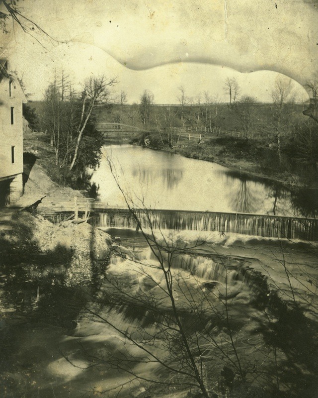
Market Square was home to this early West Side Market for nine years, from 1859 to 1868.  In the first several years of that period, it operated, as it had at Franklin Place, as an open-air market, but, in or about 1862, according to newspaper accounts, a market house—perhaps a very small wooden building of humble construction—was built on the site.  In 1868, that first market house was torn down and replaced by a new and larger market house, which the City of Cleveland named the Pearl Street Market.  The new market house occupied virtually all of Market Square and stood on the site from 1868 until 1915.</p><p>By the mid 1890s, Pearl Street Market was in a rundown condition and was too small to meet the needs of West Side vendors and customers. Plans were initially made and circulated around this time by a West Side businessmen's association to raze it and build in its place on Market Square a larger and grander market house. However, those plans changed in 1902 when Mayor Tom Johnson, who inherited the project from two of his predecessors, decided to build the new market house instead on the northeast corner of Pearl and Lorain due to land acquisition problems and renewed concerns over the validity of the City's title to Market Square. Construction of the new West Side Market began in 1907 and was completed 1912.  After the new West Side Market opened, the old Pearl Street Market House continued to stand on Market Square for several more years while the Produce Arcade for the new West Side Market was being constructed and while City officials debated other possible uses for the old market house. The Produce Arcade was completed in 1914 and, when City officials could not come to any agreement upon various proposed uses for the Pearl Street Market, it was razed in 1915.</p><p>After the old market house was razed, Market Square continued to serve the public for many years, during good weather, as an open-air market for vendors who did not have stalls across the street in the new Produce Arcade or at the West Side Market. It was also used for years as a gathering place for community events ranging from street carnivals to holiday celebrations to weddings to political speeches and protests. It was notably the site of a fiery speech given by Socialist Party candidate Charles Ruthenberg on October 28, 1917, in his bid to become mayor of Cleveland.  (He finished third in the race, but received more than 25 percent of the votes cast.)</p><p>In 1930, the City built a shelter house (also called a comfort station) on the eastern part of Market Square fronting West 25th Street, which resulted in vendor stall spaces being moved to the western portion of the Square.  It was used for these two purposes by the City until about 1950 when the shelter house was leased to a business that converted it into a popular bakery shop with the rest of Market Square serving as a parking lot for that shop.  Shortly after this occurred, a lawsuit was filed against the City of Cleveland by descendants of Josiah Barber, who for decades had been interacting with the City regarding its use of the land dedicated by their ancestor as a public square.  They alleged in their lawsuit that, by allowing Market Square to be used for "other than public purposes," the City had forfeited its right to the land and that title had by law reverted to Barber's heirs. This lawsuit remained pending in Cuyahoga County Common Pleas Court for a number of years before Judge Benjamin Nicola, having afforded the heirs numerous opportunities to amend their pleadings to state a legally cognizable cause of action, dismissed their lawsuit in 1957.</p><p>In the 1960s and 1970s, as the renaissance of the Ohio City neighborhood was underway, West Side businessmen urged the City to convert Market Square into a park.  Planning and funding for the project were started during the Perk Administration.  After initially opposing the park project on the grounds that the park would attract only "winos,"  the Kucinich Administration reluctantly undertook construction of it in 1978. The former shelter house, which in recent years had become a fast-food restaurant, was torn down. The cement parking lot behind it was removed and replaced with red brick pavers.   Brick planters were added; trees planted; and street lighting added.  Market Square Park opened to the public in 1979.  In 1984, during the Voinovich administration, a large stone, multipart sculpture called "Tempus Pons" (Time to Build a Bridge) was added to the park. The sculpture was a prominent feature of the park until around 2010-2012, when, during a park redesign, it was dismantled and somewhat unceremoniously carted away.  Market Square Park remains today (2022) a pleasant and open public space across the street from the West Side Market.  It has now occupied Market Square for more than forty years.  And to date, there have been no complaints about this use of Market Square by the descendants of Josiah Barber.</p><p><em><strong><a href="https://mail.clevelandhistorical.org/items/show/959">For more (including 20 images) view the original article</a></strong></em></p>]]></summary>
    <published>2022-05-11T18:33:02+00:00</published>
    <updated>2026-04-17T19:17:42+00:00</updated>
    <link rel="alternate" type="text/html" href="https://mail.clevelandhistorical.org/items/show/959"/>
    <id>https://mail.clevelandhistorical.org/items/show/959</id>
    <author>
      <name>Jim Dubelko</name>
    </author>
  </entry>
  <entry>
    <title type="html"><![CDATA[Kentucky Street Reservoir: Today, Cleveland&#039;s Fairview Park and Kentucky Gardens]]></title>
    <summary type="html"><![CDATA[<img src="https://mail.clevelandhistorical.org/files/fullsize/316d7b2f2105c42ac9f8734b0cfc76ac.jpg" alt="The Kentucky Street Reservoir" /><br/><p>The next time you find yourself driving down historic Franklin Boulevard between Franklin Circle and West 50th Street, take time to notice what is different about the stretch of the Boulevard between West 32nd and West 38th Streets.  It is entirely devoid of any grand houses--nineteenth century or otherwise.  Relevant to this story, on the south side of that stretch just west of the Fairview Gardens Apartments, you'll see a large community garden that extends all the way to West 38th Street. You might imagine that at one time grand mansions graced this section of Franklin Boulevard, too.  If you did, however, you'd be wrong, because this is instead where the now legendary Kentucky Street Reservoir once stood.</p><p>The Kentucky Street Reservoir was part of the City of Cleveland's first water works system.  In March 1850, Cleveland Mayor William Case, in his inaugural address, noted Cleveland's extraordinary population growth in the preceding decade--from 6,000 in 1840 to 17,000 in 1850, an increase of 180.6%--and challenged City Council to address, among other things, the issue of providing a sufficient supply of "pure water" for this growing population.  At the time, all of Cleveland's drinking water came from springs and wells.  Water for other purposes, such as cleaning, was hauled in barrels up Superior Hill from the Cuyahoga River.  Council took up the challenge and appointed a committee to study the matter.  Over the course of the next two years, the committee examined the City's water needs, talked with experts both in the United States and Europe, and observed the operations of the water works systems in a number of large cities, including Cincinnati, then the nation's sixth largest with a population of more than 115,000 residents.  </p><p>In a report delivered to the Mayor and Council in November 1852, the committee detailed its recommendations for the construction of a water works system that would provide, at least for the next decade, water for all of the city's needs, including sufficient pure drinking water for its burgeoning population, water for cleaning, water for "sprinkling" streets, and water for fighting fires. The committee also recommended that the Council hire Theodore Scowden, the engineer who had designed Cincinnati's water works system, to design Cleveland's new system. It appears Council quickly followed that recommendation, because, within a week, Scowden was, according to local news accounts, already at work as the Engineer for the City's Water Works Board. One year later in October 1853, after the State Legislature had in March authorized the project and the Cleveland electorate had in April approved its financing, Scowden submitted a report to  City Council with his recommendations for the various component parts of the new Cleveland water works system including a reservoir.  </p><p>While Council's committee in 1852 had recommended  that the reservoir for the new water works system be a masonry tower with an iron tank capable of holding one millions gallons of water, and that it be constructed on land near the intersection of Frontier (East 21st) Street and Euclid Avenue, Scowden instead recommended an earthen reservoir with a capacity of six million gallons, and that it be built not in Cleveland but across the Cuyahoga River in Ohio City.  The site he recommended was a six-acre parcel of land  located (north and south) between Franklin (Boulevard) and Woodbine (Avenue) Streets , and (east and west) between Duane (West 32nd) and Kentucky (West 38th) Streets.  Scowden's reservoir recommendation appears to have been based on advice the City had received from local engineer George W. Smith, who was familiar with Cleveland's unique topography.   According to newspaper accounts, Smith informed City officials that the higher elevation of the Ohio City site--it was 31 feet higher above the surface of Lake Erie than sites considered on the east side of the River--made it not only a safer engineering choice, but also a more cost effective one.  While some had reservations over building the reservoir for the new water works system in another city, Council--perhaps anticipating that Ohio City would soon be annexed by Cleveland--approved Scowden's recommendations in a 6-2 vote on October 12, 1853.</p><p>The Cleveland water works system designed by Theodore Scowden was constructed during the period 1854-1856.  Its main components were an aqueduct located out in Lake Erie, 300 feet from shore and 400 feet west of the western terminus of the Old River Bed; an engine house on Old River Street (Division Avenue) near Kentucky Street, which featured two massive engines for pumping; the Kentucky Street Reservoir; and some 70,150 feet (13 plus miles) of pipeline on the east and west sides of the City, which, effective June 5, 1854, included the territory of the now annexed Ohio City.  The total cost of the project was $500,000.  During the construction of the water works system and in anticipation of the Ohio State Fair to be held in Cleveland in September 1856, the City also constructed a large stone fountain, 40 feet in diameter, at the center of Public Square.  The fountain was fed water through a series of pipes that led from the Reservoir, down the hill to the Flats, then under the Cuyahoga River, and up Superior Avenue to the Square. The water works system was completed just before the Fair opened and the Public Square fountain, with its pure drinking water and its bursts of water some 30 to 50 feet into the air, became a big hit with visitors to the Fair.</p><p>The Kentucky Street Reservoir quickly became one of the most recognizable landmarks on the west side of Cleveland. It covered approximately four acres of the six-acre site upon which it was constructed and was built on a sloped 21-foot high, trapezoid-shaped embankment of sand and earth that at its base was 332 feet wide and 466 feet long.  Atop this embankment was a 25-foot-high retention basin which was 100 feet wide at its base and 15 feet wide at the top. The exterior of both the retention basin and the embankment was covered with sod.  At the top of the Reservoir--46 feet above the grade of nearby Franklin Street--was an eight-foot-wide gravel walk that encircled the basin and that was reached by ascending a flight of 70 steps on the Reservoir's north face.  On the inside of the gravel walk-- known as the Promenade Walk--there was a wooden fence which enclosed the basin. A fountain in the basin jetted water into the air.  The Reservoir's Promenade Walk, which at the time had the highest elevation of any man-made structure in the City, treated visitors to what people said was the best view of Cleveland and its surroundings. The Reservoir grounds themselves were beautifully landscaped with walks, shade trees and shrubbery.</p><p>The Kentucky Reservoir served as an important part of the Cleveland water works system for thirty years. It was abandoned as a reservoir in 1886 after completion of the new much larger Fairmount (80 million gallon) and the High Service (Kinsman - 20 million gallon) reservoirs on the City's east side.  For a decade, the fate of the Kentucky Street Reservoir, unused and, according to neighbors, an eyesore and nuisance in the Franklin Avenue neighborhood, was uncertain. Some officials wanted to dismantle it and sell the property to a residential developer, but City lawyers warned that this could cause the land to revert to the heirs of its previous owner, Benjamin F. Tyler, from whom it had been appropriated for public purposes in 1854. Others wanted to preserve it as a storage facility for the Water Works Department.  </p><p>Finally, in 1897, the City decided to convert the old Reservoir into a city park after receiving a petition from the Western Improvement Association (WIA), an organization of west and south side residents formed in 1894 to advocate for public improvements to their neighborhoods. (WIA member Horace Hannum who led the drive was  the owner of the Sarah Bousfield House which was located diagonally across Franklin from the Reservoir property.) Over the course of the next year, the Reservoir was razed, and dirt, sand and other materials from it were used to create a terraced park in its place.  The new city park, which opened in April 1898, was dubbed "Fairview," because from its terraced hills visitors could get a "fair view" of Lake Erie.  While the name stuck, its "fair views" were lost to park visitors after 1912 when the City flattened the hills and trucked away much of the dirt, sand and other materials for use in the construction of Edgewater Boulevard.  In 1917, when World War I was creating much anti-German sentiment in the city, German Hospital located next door to the park was renamed Fairview Park Hospital, the name it is still known by, even though in 1955 it moved to its present day location on Lorain Avenue in the Kamms Corner neighborhood of Cleveland.</p><p>In the 1930s,  Fairview Park was extensively redeveloped during the administration of Mayor Harold Burton.  A playground and wading pool for children--many undoubtedly students attending nearby Kentucky Elementary School--were added in 1938.  Walking paths and a baseball diamond were also added to the park during this period.  A section of the park was also set aside during this period as a vegetable garden which was tilled for decades by school children under a Cleveland public schools agricultural program.  In the 1980s, this school garden became a community garden for residents of the Ohio City neighborhood.  Today, the former site of the once famous Kentucky Street Reservoir is home to both the community garden known as Kentucky Gardens,  located on the northern part of the old Reservoir property, while what is left of the original Fairview Park now occupies only the southern part of the historic site.</p><p><em><strong><a href="https://mail.clevelandhistorical.org/items/show/945">For more (including 15 images) view the original article</a></strong></em></p>]]></summary>
    <published>2021-05-21T22:44:12+00:00</published>
    <updated>2026-04-17T19:17:42+00:00</updated>
    <link rel="alternate" type="text/html" href="https://mail.clevelandhistorical.org/items/show/945"/>
    <id>https://mail.clevelandhistorical.org/items/show/945</id>
    <author>
      <name>Jim Dubelko</name>
    </author>
  </entry>
  <entry>
    <title type="html"><![CDATA[The Old Cleveland Aquarium: &quot;Brick By Brick... Fish By Fish... Drop By Drop&quot;]]></title>
    <summary type="html"><![CDATA[<p><strong><em>Cleveland's first aquarium, located in Gordon Park, was the product of a unique collaboration of public agencies and citizen volunteers. With support from the City and the Cleveland Museum of Natural History, volunteers fashioned the aquarium from a former bathhouse-turned-museum. Although it operated for barely a generation, the old Cleveland Aquarium played a role in elevating the stature of aquariums as serious marine research centers.</em></strong></p><img src="https://mail.clevelandhistorical.org/files/fullsize/15c4fb1b8d86da8218e5c1a2db4d598d.jpg" alt="Cleveland Aquarium Expansion Plans" /><br/><p>The <em>Cleveland Plain Dealer</em> announced the grand re-opening of the Cleveland Aquarium in its September 5, 1954 edition, citing it as the “most public institution of its kind.” The unique aspect of the Aquarium’s development in Gordon Park was the “brick by brick... fish by fish... drop by drop” building of the facility by the Cleveland Aquarium Society, Cleveland Museum of Natural History (CMNH), as well as volunteer "sportsmen, amateur marine biologists, teachers, housewives, and youngsters." The effort began in 1954 when the building, utilized as a Trailside Museum, was threatened with closure. Aquarium Society members contributed material, labor, and fundraising efforts to retrofit the trailside facility to house a public aquarium.</p><p>Gordon Park had evolved from a bathing beach attraction on Cleveland’s east side along Lakeshore Boulevard during the 1940s and 1950s. The construction of an improved Memorial Shoreway (later part of Interstate 90) split the park into a lakefront boat access area and an inland park area with sports fields and picnic areas. The limited beach access and usage led the former bathhouse on the inland grounds to be converted to a Trailside Museum by CMNH in 1943. It housed natural history specimens of the area, including several small aquariums containing fish from Doan Brook and Lake Erie. The opportunity to create a large, dedicated, public aquarium became a reality with the cooperative efforts of the city, CMNH, and the volunteers who planned and built the facility to house local aquatic specimens as well as tropical species in a controlled habitat. Director William Kelley characterized the Cleveland Aquarium as an applied research center—as opposed to a “fish circus”—and hoped to continue the research theme to influence other aquaria around the world. </p><p>By the time the grand opening occurred, existing display tanks were renovated and ten 500-gallon tanks were installed to welcome aquatic life to Cleveland’s lakefront. The early years of the aquarium saw the expansion of the aquatic life collection via ‘expeditions’ to the Florida Keys. Staff and volunteers organized trips and contributors to harvest specimens and safely ship them back to Cleveland to include in the collection. During one 1955 "safari," aquarium staff returned with a baby shark, a moray eel, a sea turtle, a porcupine fish, and a spiny box fish among others. The staff was challenged to ship the specimens in their habitat and to acquire 600 gallons of ocean water for their new home. This challenge was met by the Aquarium staff who later improved upon a German colleague's formulated substitute seawater and dubbed it Instant Ocean. In 1964, Director Kelley left the Aquarium and patented the successful compound and founded Aquarium Systems, Inc. to market Instant Ocean and continue refinements here and in Europe for international distribution.</p><p>Throughout these developmental years, the Aquarium distinguished itself as a research facility beyond the role of museum collections and display of aquatic life. The growth and success of the Aquarium program was well received by the public and private funders alike. Museum visitors grew annually and foundation and corporate contributors supported the efforts. By the mid 1960s, these successes called for the expansion or development of a larger aquarium in Cleveland. After several proposals to relocate the facility, an expansion of the existing facility was agreed upon and a $300,000 grant from the Leonard C. Hanna Jr. Fund supported the tripling of the existing site. The continued growth of the Aquarium included cooperative efforts with universities and other aquarium programs. These initiatives enhanced its stature in the world of aquatic science. The species collection represented worldwide contributions of varieties of freshwater and ocean specimens.</p><p>The operation of the Aquarium was influenced by the nature of its creation. The contributions of volunteers and the cooperation of the CMNH to operate the Aquarium prompted the City of Cleveland to support the effort—Cleveland owned Gordon Park where the Aquarium stood. Annual reports indicated operating costs of $20,000-$30,000 with the city underwriting $17,000 and admissions, CMNH support, and occasional foundation contributions to cover costs. The revenue routinely fell short of expenses despite the increased annual attendance and popularity of the attraction. The multi-faceted budget became a political process. By 1961, CMNH began to study the option to separate the operation of the Aquarium and discussions began about its expansion. Throughout the 1970s operations persisted and the city maintained its annual $17,000 subsidy despite mounting annual deficits reaching $140,000 culminating in a showdown with Cleveland Mayor Dennis Kucinich in 1979. Increased external funding support and city council’s override of the mayor’s veto of increased admission fees kept the aquarium open for the foreseeable future. As the 1970s drew to a close, ’Moses,' the biggest and oldest resident grouper, died, perhaps signaling the aquarium's fate.</p><p>The early 1980s brought additional debate with the city which would decide the Aquarium’s future. Plans brought by private developers to relocate the Aquarium with other maritime museums in the Nicholson building (East 55th at Lake Erie shore) conflicted with the city’s proposal to develop the lakefront at East 9th Street to include a new aquarium. The administration of Mayor George Voinovich prevailed to support the downtown plan which never materialized as announced—instead the Rock and Roll Hall of Fame and the Great Lakes Science Center occupy the space. By 1985, structural problems due to saltwater corrosion emerged at the Gordon Park facility. Collapsed ceiling panels forced its closure in June 1985 and further negotiations removed the Cleveland Aquarium’s contents and program from CMNH oversight at Gordon Park to the Cleveland Metroparks Zoo in 1986 with continued hope of a new facility at the Inner Harbor. Discussions among aquarium supporters remained active through 2009, when developer Jeff Jacobs announced a project partnering with external developers and consultants to locate a new aquarium in the downtown Flats.</p><p><em><strong><a href="https://mail.clevelandhistorical.org/items/show/874">For more (including 11 images) view the original article</a></strong></em></p>]]></summary>
    <published>2019-10-09T01:05:59+00:00</published>
    <updated>2026-04-17T19:17:42+00:00</updated>
    <link rel="alternate" type="text/html" href="https://mail.clevelandhistorical.org/items/show/874"/>
    <id>https://mail.clevelandhistorical.org/items/show/874</id>
    <author>
      <name>Jim Lanese</name>
    </author>
  </entry>
  <entry>
    <title type="html"><![CDATA[Sutton Place: An Experiment with Suburban Renewal]]></title>
    <summary type="html"><![CDATA[<p><strong><em>Following five years of land acquisitions, demolition and construction, the Sutton Place townhouse development opened for sale to the public in May of 1971.  The experimental, aluminum-based housing project was designed to draw middle- and upper-class professionals into the Moreland neighborhood.  The new housing emerged from a controversial urban renewal project headed by the City of Shaker Heights during the late 1960s, and was greeted with picket signs by the Cleveland Association of Real Estate Brokers.  Learn why...   </em></strong></p><img src="https://mail.clevelandhistorical.org/files/fullsize/d30be98a5b9ab816657464798ced5af6.jpg" alt="Architectural Sketch of Sutton Place Townhouses, 1970" /><br/><p>Standing before a crowd of 200 community members in the fall of 1968, City of Shaker Heights Mayor Paul K. Jones offered his assurances to constituents gathered at Shaker Heights High School Auditorium. An urban renewal plan had sparked public debate over the future of Shaker Heights’ Moreland neighborhood, and the role that the City would play in shaping its landscape. Mayor Jones urged those in attendance to support the passage of bond issues totaling $7.25 million in an upcoming November election to help the “maturing city regain its youth.” The proposed development, however, went beyond cosmetic adjustments for an aging infrastructure. Both homes and commercial structures would need to be razed for the construction of a new service center and townhouse project. Over 200 families would be displaced.  </p><p>The urban renewal efforts were dependent on the public’s approval of three bond issues by a 55 percent majority vote. A $4 million bond would finance the construction of a service center on Chagrin Boulevard between Ludgate and Menlo Roads. The installation of 41 traffic signs, the relocation of city utilities for townhouses, and the widening and improvement of over a dozen streets was attached to the passage of a $3 million bond. A $250,000 park improvement bond funded the creation of a semi-public green space for the townhouse site, as well as providing for the creation of additional public spaces in Shaker Heights’ southwestern region. The proposed park and townhouse project, which would later be named Sutton Place, encapsulated the goals of this urban renewal effort: to physically recreate the Moreland neighborhood as a way of stabilizing property values and promoting the “re-integration” of white residents.  </p><p>The projects, and their supporting bond issues, grew from an ambitious and highly controversial redevelopment plan created by Leonard Styche and Don Hisaka for the City of Shaker Heights. Their focus on the Moreland neighborhood was prompted by efforts to stabilize the community. During the 1960s, homes in Moreland had been placed on the resale market at an alarming rate and the community transitioned from nearly all white to over two-thirds African American. Concurrent efforts to shape and support these urban renewal plans were spearheaded by the Shaker Communities Housing Office.  </p><p>Funded by both the City’s government and school system, the organization was established in 1967. Four housing coordinators were hired from the membership of the Moreland, Ludlow, Lomond and Sussex community organizations in order to aid realtors with selling properties in their respective neighborhoods. The Housing Office worked in collaboration with and generally towards the same ends as the community organizations. The group expressed concerns that if the Moreland community became exclusively African American, then other neighborhoods would follow “one by one.” While the community associations were a positive force in advocating for integration and promoting diversity as a value of Shaker Heights’ collective identity, their work during the late 1960s often focused on attracting white homeowners to the Moreland neighborhood. Support of the park-townhouse project was one such effort. </p><p>The gathering at Shaker Heights High school was not the first public meeting over the proposed redevelopment efforts. Since the Styche-Hisaka Plan was announced in February of 1967, objections, suggestions and revisions had been discussed at length by local community associations, block clubs, the Housing Office, concerned citizens and government representatives. Plans for a Civic Center in the Moreland neighborhood had been scrapped, and new emphasis was placed on diverting traffic flow away from residential neighborhoods and creating green spaces at the request of the public. The Mayor also promised that the City would assist with the relocation of those impacted by the urban renewal efforts. </p><p>A revised master plan was now on the table for a public vote. A representative of William Gould & Associates, the architectural firm employed to design Sutton Place, manned a slide projector to accompany Mayor Jones’ pitch to the concerned citizenry. Maps and photos offered those in attendance a glimpse at a possible future for the Moreland neighborhood’s townhouse and park space. The housing stock and grid layout, both of which developed outside of the control of the Van Sweringen Company during the 1920s, would be revamped with curvilinear streets and low-density housing.  </p><p>The proposed Sutton Place development not only aimed to aesthetically unify the area with surrounding Shaker Heights neighborhoods, but to act as a physical barrier between the City of Cleveland and the inner suburb. The neighborhood grid was reshaped with a cul-de-sac that encircled the townhouse and park, and blocked incoming northern traffic from Kinsman Road in the City of Cleveland. In addition to new traffic patterns, 85 homes on six acres would be replaced with 15 townhouses that half-encircled open park grounds. While not yet approved by voters, the City began its efforts to acquire properties within the area beginning in January, 1966. </p><p>With support from the City’s community organizations, Shaker Heights voters overwhelmingly approved all three bond issues on November 5, 1968. The demolition of properties on Sutton (East 150th Street) and Colwyn (East 152nd Street) Roads began in January, 1969. Only one house remained at the western edge of the proposed development by November. Through its efforts to provide assistance with relocation, the City tracked 85 of the 140 families displaced by the townhouse project. Forty families relocated within Shaker, and 16 moved to Cleveland. Twenty-six single family homes and 59 duplexes were removed from the grounds. In their place, a townhouse complex emerged.  </p><p>Sutton Place grew from a proposal in the Styche-Hisaka Plan to provide alternative housing options that retained “the characteristics of a fine residential community” for potential middle- and upper-class homeowners. A planned townhouse development offered “the amenities and advantages of home ownership and the conveniences of apartment living.” Designed by William Gould & Associates for Alcoa Constructions Systems, Inc., the project was an experiment in using aluminum for residential construction. Structural components, as well as windows and exterior siding, were forged of aluminum to create durable, energy efficient and weatherproof residential housing.  </p><p>The City of Shaker Heights Planning Commission approved plans for the Sutton Place Townhouse Development on July 20, 1970. Construction began soon after. While the City acquired the grounds, the townhouses were built and sold under Alcoa Construction Systems, Inc. Plans for the two-story townhouses centered on the park space. Living and dining areas opened up to patios at the rear of the entrance, which faced outwards towards the semi-public grounds. Thirty townhouses comprised the park-townhouse development at completion, and prices ranged between $35,500 to $37,000 (corresponds to $235,000 in 2018). The townhouses opened for display to the public in May, 1971.  </p><p>The construction of mid-priced, modern townhouses in Shaker Heights was an effort to promote integration in the Moreland neighborhood. Prior studies by the Moreland Community Association noted that white families were willing to rent in the neighborhood, but not buy homes. This was attributed to the unmodern look and interior layout of the aging housing stock. Joseph Laronge, Inc., the real estate company handling sales of Sutton Place for Alcoa, noted, “we plan Sutton Place to be a special way of living, we hope to have true integration here in a way that will make this a model community.” The new housing, however, predominately attracted upper-income, professional African Americans. The park and townhouse project still succeeded in its goals. The landscape had been reshaped and clearly delineated as a Shaker Heights community. The upper Moreland neighborhood was visually and physically set apart from the City of Cleveland at its western and southern boundaries. The neighborhood’s population density fell, and urban housing stock was replaced with green space and contemporary residences. Despite the successes of the Sutton Place project, public debate over the redevelopment and re-integration of the Moreland neighborhood continued. </p><p>Upon opening its model home to potential buyers in 1971, the Sutton Place townhouses also attracted picket signs of the Cleveland Association of Real Estate Brokers (CAREB). The African American association demanded the right to have a real estate agent on premises at Sutton Place, and to present qualified candidates for sales. Alcoa had previously extended exclusive selling rights to the white-owned Joseph Laronge, Inc. While CAREB was eventually invited to be on site during sales, and an uncharacteristic 50-50 split of commission was proposed by Joseph Laronge, Inc., the offers were refused. CAREB rejected on the grounds that African American real estate agents would not be able to go into a white community and sell new housing under similar conditions. They demanded full commission. While this request was denied by Laronge, the protest by CAREB reflected a larger, ongoing public debate over both the City’s urban renewal plans and reintegration efforts in the Moreland neighborhood. The role of the City and the community associations in both refashioning the physical landscape and promoting the reintegration of white residents in African American communities increasingly came under fire from the public during the 1970s and 1980s. These debates eventually advanced a more nuanced, balanced and self-reflective approach to advocating for integration in white and African American neighborhoods by the City of Shaker Heights and its neighborhood community associations. The City of Shaker Heights has continued to promote integration and pursue redevelopment projects that diversity housing stock within its southern neighborhoods. A new townhouse development, The Van Aken Townhouses, opened for sale in 2018 and is planned to include 33 new-construction townhomes near the intersection of Sutton Road and Van Aken Boulevard.</p><p><em><strong><a href="https://mail.clevelandhistorical.org/items/show/843">For more (including 8 images) view the original article</a></strong></em></p>]]></summary>
    <published>2018-07-20T04:44:46+00:00</published>
    <updated>2026-04-17T19:17:40+00:00</updated>
    <link rel="alternate" type="text/html" href="https://mail.clevelandhistorical.org/items/show/843"/>
    <id>https://mail.clevelandhistorical.org/items/show/843</id>
    <author>
      <name>Richard Raponi</name>
    </author>
  </entry>
  <entry>
    <title type="html"><![CDATA[Geauga Lake: An Environmental History]]></title>
    <summary type="html"><![CDATA[<img src="https://mail.clevelandhistorical.org/files/fullsize/3683da36546c8e1c6b6675425a0b3414.jpg" alt="Geauga Lake in the 1930s" /><br/><p>Many think of Geauga Lake as a popular amusement park for much of the 20th century, but it has a little-known environmental history. The lake has existed for millennia and human activity has impacted it for a very small portion of its existence. The lake formed in a time before humans, saw the tenure of Native Americans, pioneers and settlers, and eventually urbanites seeking short excursions for leisure and recreation. Throughout these phases, Geauga Lake influenced local residents, and they, in turn, influenced the lake.</p><p>Geauga Lake is a "kettle" that was left behind during the retreat of the Wisconsin glaciation, which occurred about 12,000 years ago. As the glaciers retreated north, they scoured the land and left behind Geauga Lake, as well as other natural lakes. The land surrounding the lake was eventually inhabited by beech forests, the result of ecological succession, which would cover this area of Ohio for years. The land also consisted of silt loam soils, which are rich with nutrients. The fruit bearing vegetation and water brought animals like the now extirpated elk, panther, wolf, bear, wild cat, and beaver.</p><p>From 9500 B.C. to nearly the 18th century, different groups of Native Americans inhabited in northeastern Ohio. These groups from earliest to latest are the Paleo-Indians, Archaic Indians, the Woodland period, the Whittlesey Focus, and the Proto-historic period. There is some uncertainty about Native American boundaries, but it was once thought that perhaps the Erie people, a Proto-historic Iroquoian tribe, inhabited the lands including Geauga Lake. The current consensus is that these lands were instead inhabited by the Whittlesey Focus people and varying tribes until the pioneer era. Regardless, Erie and Whittlesey Focus cultures may give some insight into the interplay between human cultures and the environment around Geauga Lake. The Erie people were called “nation du Chat,” or the Cat Nation, by the French in the Jesuit Revelations of 1641. No Europeans ever officially met a member of the Erie people, but the Erie are said to have built palisaded towns on rivers such as the Chagrin and used these lands for hunting grounds. Similarly, the Whittlesey Focus people had towns with earthen walls topped with wooden stockades. Both groups grew corn, squash, and beans on a small scale. Geauga Lake may have been part of the hunting grounds of either of these groups, but it is unclear how the lake was used and viewed by native people. Compared to today, the lake was still relatively untouched and pristine, but the cultural importance of the lake to native people may never be discovered.</p><p>By the mid-18th century, Northeast Ohio was uninhabited by native people and by the end of the 18th century, white settlers began to arrive in the area. Joel S. Giles was not the first settler in the area, but he bought 100 acres of farmland near the lake for $4.00 an acre in 1817. The lake was named Giles Pond and eventually the Geauga Lake rail depot was constructed as part of the Erie Railroad. Eventually known as Picnic Lake, the lake brought people and groups for fishing, as well as for picnics and other group recreational excursions on the land around it. Soon it was known by its present name, Geauga Lake, and the 75-room Kent House was built in 1888 to accommodate recreation seekers. The lake fell under increasing pressure from human use, which gradually diminished the natural qualities that first brought people there. This paradox presents itself throughout much of the rest of the lake’s history.</p><p>Geauga Lake and the surrounding land was slowly transformed into an amusement park, beginning with a “primitive merry-go-round,” as stated by the Plain Dealer in a 1981 article on the park’s history, and growing to encompass a multitude of rides and roller coasters. Large swaths of trees were removed and massive amounts of concrete infrastructure, including parking lots, were installed to accommodate increasing numbers of patrons. As people left Cleveland to find amusement, the lake was being polluted and the land, contaminated. By 1970, the lake was almost fully surrounded by Geauga Lake Park and the newly opened Sea World of Ohio, which later became rebranded under the ownership of Six Flags and Cedar Fair. The lake and wetlands that make up the Geauga Lake site became less effective at filtering and slowing down the waters the flow into the Tinker’s Creek and Chagrin River watersheds. Installation of concrete infrastructure and asphalt parking lots replaced hydric soils, which are important for wetland and riparian function. On September 21, 2007, Cedar Fair, the current owners of the lake, closed down Geauga Lake Park and eventually Wildwater Kingdom, formerly Sea World, on the east side of the lake a few years later. </p><p>The land now sits, amusement park torn down, a shadow of its former self in the eyes of local residents. Parking lots, concrete pilings, and abandoned buildings dot the landscape. The lake has storm water runoff issues, leading to algae problems. The soils under the impervious surface may be contaminated with various chemicals including solvents and herbicides. Nonetheless, the potential for the lake to return to a more natural state, possibly bringing balance to the natural needs and human wants to the lake, presents itself. Plans are being developed to repurpose the site, but the outcome remains uncertain. Strong leadership backed by a small fortune can bring harmony between humans and nature back to Geauga Lake.</p><p><em><strong><a href="https://mail.clevelandhistorical.org/items/show/795">For more (including 12 images) view the original article</a></strong></em></p>]]></summary>
    <published>2017-05-13T21:53:49+00:00</published>
    <updated>2026-04-17T19:17:41+00:00</updated>
    <link rel="alternate" type="text/html" href="https://mail.clevelandhistorical.org/items/show/795"/>
    <id>https://mail.clevelandhistorical.org/items/show/795</id>
    <author>
      <name>John Micklewright</name>
    </author>
  </entry>
  <entry>
    <title type="html"><![CDATA[Masterson-Bivins Park: Twice Dedicated, Twice Forgotten, and Now Remembered]]></title>
    <summary type="html"><![CDATA[<p><strong><em>It is one of Cleveland's smallest parks.  Not much more than a patch  of grass and a lamp post on the northwest corner of West 25th Street and Detroit Avenue.  But it is an important public space-- dedicated twice, over the course of the last ninety years, as a memorial to two different legendary Clevelanders--Ward Eight political boss Bernard "Brick" Masterson and famed boxer James Louis "Jimmy" Bivins.</em></strong></p><img src="https://mail.clevelandhistorical.org/files/fullsize/33a01ceebda7a1f7819cba73d7f650f2.jpg" alt="A Very Small Park" /><br/><p>It  was, in the first place, road and bridge improvements that created the park — almost as an afterthought.  For much of the first two decades of the twentieth century, the city of Cleveland had planned and then constructed Bulkley Boulevard (today, the west Shoreway) and then the Detroit-Superior Bridge, thereby providing more direct access for Clevelanders living on the east side to travel to Edgewater Park on the west side.  To address anticipated congestion from traffic coming off the new bridge near West 25th Street, the city purchased, and in 1917 razed, several buildings on Detroit  and Vermont Avenues, immediately west of West 25th, using part of the  cleared land  to create a fan-shaped entrance way onto Bulkley Boulevard.  The land that was left over after the fan-shaped entrance way had been created?  Well, little thought was apparently given to it until west side Councilman Michael H. Gallagher came along and decided that the remnant land should be a park serving as a memorial to Bernard "Brick" Masterson.</p><p>In 1917, Gallagher, a Republican, had been elected Ward Eight Councilman — the ward that then encompassed much of the near west side — defeating three-term incumbent Democrat,  William J. Horrigan.   Gallagher owed much of his electoral success to Brick Masterson, the Republican ward leader.   Masterson, who also was owner of a popular saloon at 1313 West 25th Street, was known on the west side as  "Mayor of the Angle."  This was perhaps due to his success in turning out the Republican vote in 1909, which contributed significantly to the stunning defeat  of Cleveland's most famous mayor, Tom L. Johnson.  Nine years after Johnson's defeat, and just four months after he engineered Michael Gallagher's  victory  over incumbent Councilman Horrigan, the 44-year old Masterson died tragically from a fall he suffered on St. Patrick's Day.  </p><p>While other politicians likely forgot the colorful ward leader soon after his very public funeral, Councilman Gallagher did not.  In 1921,  several years after the entrance way to Boulkley Boulevard at West 25th and Detroit had been created, he successfully sponsored legislation to make that small leftover piece of land a park named "Masterson Square."  And while some may have poked fun at the little park, as the Plain Dealer did in an article published in 1926, for decades Masterson Square served as a gathering place for community events in the historically Irish Old Angle neighborhood.  As late as 1944, it  was the site of a gala fundraising event for the new memorial chapel at nearby St. Malachi Catholic Church.  And then, apparently, as time passed, and the ethnic composition of the neighborhood changed, the park lost its public identity as a memorial to Brick Masterson.  </p><p>In the year 2000, eight decades after the park had been first named as the result of one Cleveland councilman's efforts, another Cleveland councilman came along — Ward 14's Nelson Cintron, who decided that it would be a great idea to honor boxing great Jimmy Bivins by naming the park, which was by this time apparently only known to city officials as the "Detroit-West 25th Street park,"  after him.  </p><p>James Louis "Jimmy" Bivins, an African American whose family moved from Georgia to Cleveland in 1921 during the Great Migration, was one of the city's best boxers ever, fighting both as a light heavyweight and as a heavyweight.  His professional career lasted from 1940 to 1955, during which time he amassed a record of 86-25-1.  During the years of World War II, he won the "duration" championship — awarded when Joe Lewis and others were away in the service — in both the light heavyweight and heavyweight classes.  Bivins retired from boxing in 1955, but afterwards he became  a trainer at the Old Angle Gym, which for many years was located in the Campbell Block, a building catty-corner across the street from Masterson Square.  There, Bivins not only trained young men--many of whom came from impoverished areas of the near west side, but he also became a partner in the operation of the gym, contributing his money as well as his time to keeping the gym going, at a time when many Cleveland boxing gym owners were hanging up their gloves for good.  After the Campbell Block was torn down in 1975, Bivins moved the gym first to the West Side Community House at West 30th Street and Bridge Avenue, and then in 1978 to St. Malachi School, where he taught boxing to kids there until 1996 when old age and personal tragedy ended his career as a trainer.</p><p>On October 4, 2000, Cleveland City Council passed Councilman Cintron's sponsored legislation to name the little park at the corner of West 25th and Detroit Avenue  "Jimmy Bivins Park."  But no plaque or other signage was ever put up to identify the park.  And so it remained for fifteen years until 2015, when a redevelopment proposal came before the City that included the land upon which the park was located.  During the redevelopment review process, the City not only learned that the proposal included land that was a city park, but also that the park had been named on two different occasions in honor of two different legendary Clevelanders.  City officials are now considering  the possibility of upgrading the park, and, hopefully, once and for all, resolving its name.</p><p>2021 Update:  Apparently, the City has resolved the issue of the twice-named little park by reaffirming that it is Jimmy Bivins Park in honor of the late, great Cleveland boxer. Signage honoring Bivins has gone up in the park area on the northwest corner of Detroit Avenue and West 25th Street.</p><p><em><strong><a href="https://mail.clevelandhistorical.org/items/show/752">For more (including 12 images) view the original article</a></strong></em></p>]]></summary>
    <published>2015-12-16T07:42:43+00:00</published>
    <updated>2026-04-17T19:17:41+00:00</updated>
    <link rel="alternate" type="text/html" href="https://mail.clevelandhistorical.org/items/show/752"/>
    <id>https://mail.clevelandhistorical.org/items/show/752</id>
    <author>
      <name>Jim Dubelko</name>
    </author>
  </entry>
  <entry>
    <title type="html"><![CDATA[Boxing in the Old Angle Neighborhood: From Johnny Kilbane to Jimmy Bivins]]></title>
    <summary type="html"><![CDATA[<p><strong><em>Cleveland has a rich history of amateur and professional boxing.  Much of it derives from the establishment of a number of athletic clubs and gymnasiums that were started on the near west side in the the late nineteenth and early to mid-twentieth centuries.  St. Malachi's La Salle Literary and Athletic Club in 1894.  Jimmy Dunn's gymnasium at 2618 Detroit in 1910.  Danny Dunn's gymnasium at 2861 Detroit in 1927.  And, the Old Angle Gym in the Campbell Block on  West Superior Avenue in 1943.  These gyms--which over the years trained hundreds, if not thousands, of amateur and professional boxers, including featherweight champion Johnny Kilbane, top heavyweight contender Johnny Risko, and "duration" champion Jimmy Bivins, were all located at or near the intersection of West 25th Street and Detroit Avenue, making the area--just south of the Old Angle neighborhood, an historic epicenter of boxing in Cleveland.</em></strong></p><img src="https://mail.clevelandhistorical.org/files/fullsize/27a4ec60c18084f2f426ee321ca18f50.jpg" alt="The Epicenter of Boxing in Cleveland" /><br/><p>Boxing in the Old Angle, an historic Irish neighborhood located on Cleveland's near west side, has deep roots,  reaching back at least as far as the year 1894 when Brother Salpicious of the Christian Brothers of the La Salle Order founded the La Salle Literary and Athletic Club at St. Malachi school for boys on the corner of Pearl Street (West 25th) and Division Avenue.  The Club encouraged boys attending St. Malachi to engage in a number of sports, including boxing.  It achieved national attention in 1912 when it sponsored the St. Patrick's Day parade in Cleveland, featuring new featherweight boxing champion Johnny Kilbane, who had learned to box at the La Salle Club in the first decade of the twentieth century.</p><p>As young school boys who trained at the La Salle Club grew older, other, more professional places were needed to provide continued training in the sport of boxing.  Johnny Kilbane, and others like Tommy Kilbane (no relation), Tommy (later "Black Jack") McGinty, and "Young Brick" Masterson, at first often had to travel out of the  Old Angle neighborhood to places like Volk's Gymnasium downtown on Prospect Avenue to train.  But in 1910, that changed when Jimmy Dunn, legendary trainer of Johnny Kilbane and other early twentieth century fighters, opened his first professional gym in the Angle neighborhood at 2618 Detroit Avenue--just a block west of the intersection of West 25th Street and Detroit.  According to an article which appeared that year in the Plain Dealer, Dunn's new establishment was "fitted up as completely as any gym in the city."  Johnny Kilbane was training out of Dunn's Gym at 2618 Detroit when he won his featherweight boxing crown in 1912.</p><p>Other gyms sprouted up in the neighborhood, and elsewhere, as the sport of boxing--thanks in large part to Johnny Kilbane's fame, became more popular in Cleveland in the 1920s and was viewed as a way to climb out of poverty, despite official discouragement of the sport from City Hall.  Jimmy Dunn's Gym at 2618 Detroit saw a succession of new owners, including Tommy "Black Jack" McGinty, the Frisco Club and others, including former boxer Bryan Downey who, around 1930 closed the gym at this location and opened a new one downtown on Superior.  Danny Dunn (a cousin of Jimmy Dunn), who for a short time managed the gym his cousin had founded, opened his own gym just up the street at 2816 Detroit in 1926. It became a neighborhood fixture for over a decade, training many boxers, until it closed around 1941.  Its most well-known boxer was Johnny Risko, a Slovak immigrant and heavyweight boxer, who trained at the gym in the decades of the 1920s and 1930s when he was one of the top contenders in the United States for the heavyweight crown.</p><p>Shortly after Danny Dunn's gym closed, as well as Bryan Downey's downtown in the same year, a movement appears to have begun in 1943 to bring a boxing gymnasium back to the Old Angle.  Prominent among the people involved in the movement was John A. Keough, a third generation Irish-American born in the Angle neighborhood, whose son John M. "Jackie" Keough, a welterweight, was one of the top boxers in Cleveland in the 1940s.  In or about 1943, Keough and a partner opened a gym in two rooms and an allotted basement area of the Campbell Block, an historic building erected in 1891 by Alexander Campbell, the grandfather of another famed fighter--Admiral Isaac Campbell Kidd, who went down fighting on the USS Arizona at Pearl Harbor on December 7,  1941.  </p><p>Located near St. Malachi Church and just a block north of the intersection of West 25th and Detroit Avenue, the gym was named the "Old Angle" gym, according to one source, by former boxing champion Johnny Kilbane.  For much of the next three decades, the Old Angle Gym was THE place to train on the west side of Cleveland. It operated out of the Campbell Block from 1943 until 1949.   In 1950, Keough opened a new Old Angle Gym  in the Rhodes Building at 1699 West 25th Street. This Old Angle Gym—sometimes also called the Old Angle Athletic Center— remained at that location until 1959, when Keough moved it back to the Campbell Block.  </p><p>One of the boxers attracted to the Old Angle Gym was James Louis "Jimmy" Bivins, an African American, whose family moved to Cleveland from Georgia in 1921 when he was just two years old.  Bivins fought as both a light heavyweight and heavyweight, winning the "duration" title in both weight classes during World War II.  After retiring from boxing in 1955, Bivins returned to the Old Angle gym to become a trainer, introducing a whole new generation of  kids living in the neighborhood to the "sweet science," including bantamweight Gary Horvath, who won multiple Golden Gloves championships in the decade of the 1960s.  Later, after Keough and his partners retired from management of the gym, Bivins and Horvath took over, operating the Old Angle Gym out of the Campbell Block until that building was torn down in 1975.  Afterwards, the two operated a boxing gym for several years in the West Side Community Center at West 30th Street and Bridge Avenue, and then Bivins opened up a boxing gym at St. Malachi Church--where it all started, for neighborhood youths in 1979, running it until the mid 1990s. </p><p>In the year 2000, in recognition of the contributions which Jimmy Bivins made to the community both as a legendary boxer and as a trainer of young boxers on the near west side,  the City of Cleveland, figuratively speaking, returned to the historic intersection of West 25th Street and Detroit Avenue, passing legislation to name the little park on the northwest corner of  that intersection "Jimmy Bivins Park."  Unknown to city officials at the time, the same park had eighty years earlier been dedicated as a memorial to Bernard "Brick" Masterson, a popular near west side ward leader, who was also associated with the sport of boxing--as a member of the historic La Salle club and as the father of a promising young boxer who, in the early days, trained with Johnny Kilbane in Jimmy Dunn's gym on  Detroit Avenue.  No matter the inadvertent slight to "Brick."  Had he been alive to witness the renaming of his park,  he probably would have been honored to share it with a man like Bivins.  It would be  entirely in keeping with history and tradition at this epicenter of boxing in Cleveland.</p><p><em><strong><a href="https://mail.clevelandhistorical.org/items/show/750">For more (including 13 images) view the original article</a></strong></em></p>]]></summary>
    <published>2015-11-30T05:22:25+00:00</published>
    <updated>2026-04-17T19:17:41+00:00</updated>
    <link rel="alternate" type="text/html" href="https://mail.clevelandhistorical.org/items/show/750"/>
    <id>https://mail.clevelandhistorical.org/items/show/750</id>
    <author>
      <name>Jim Dubelko</name>
    </author>
  </entry>
  <entry>
    <title type="html"><![CDATA[Frostville: Resurrecting the Ghosts of a Rural Past in Suburban North Olmsted]]></title>
    <summary type="html"><![CDATA[<img src="https://mail.clevelandhistorical.org/files/fullsize/d6fdd3017157418674b5c5248ee4da98.jpg" alt="Rocky River Valley" /><br/><p>Awakened from the grave on a chilly October evening in 1975, the ghostly manifestation of Western Reserve pioneer Thomas Briggs greeted trespassers at the Frostville Museum complex in Cleveland Metroparks Rocky River Reservation with scowls and threats of retribution over the displacement of his beloved home. Brave tour leaders steered visitors towards the not-quite-living history exhibition of Briggs’s partially renovated residence, regaling them with details from letters penned by the phantom docent. The writings, compiled by the Olmsted Historical Society, recounted the labors involved in constructing the home and the settler’s joy upon its completion. The specter could have shown a bit more gratitude; the house was previously slated for demolition but had been rescued by the historical society. With funds scraped together by hosting events such as annual antique auctions, members had managed to relocate a 20 x 40 foot section of the 139-year-old home from Lorain Road in North Olmsted to museum grounds in 1969. Efforts to restore the Greek Revival style building in accordance with its original design were well underway. The sturdy home’s new neighbors included a farmhouse erected in 1877,  a small storage shed containing a horse-drawn hearse, and a recently constructed barn that displayed farm tools and a vintage fire engine.   The tiny pioneer village of Frostville was slowly being assembled within the rural terrain of the Cleveland Metroparks system. </p><p>Since the allocation of Frostville's grounds for use as a public museum in 1962 by Cleveland Metroparks, a handful of Olmsted Historical Society members stationed out of a farmhouse worked tirelessly to resurrect ghosts of the region’s earliest European and American settlers.  The group was founded in 1953 as the North Olmsted Historical Society. Its members were not alone in their efforts to unearth a world whose demise was symbolized by highways and generic housing stock. In North Olmsted, and across the United States, the changes wrought by suburbanization spurred the establishment of organizations dedicated to preserving relics of local history.  By the end of the postwar suburban boom, Cuyahoga County had no less than 28 historical societies devoted to conjuring up the restless souls of a distant—and often imagined—past.</p><p>This post–World War II era marked the beginning of rapid change in North Olmsted and its surroundings, and it offers the backdrop for the historical society's invocation of the Briggs ghost. Across the United States, urban sprawl and suburbanization transformed the character and landscape of small communities situated outside urban centers.  Consumer spending that had been restrained during the Great Depression and World War II was unleashed. Demand for homes and consumer goods skyrocketed. </p><p>A slight complication quickly came to light. The construction of new housing had been at a relative standstill in an economy marked by rationing. The public not only had freshly available reserves of money, but Depression-era federal policies offered Americans greater access to affordable, long-term loans. The passage of the G.I. Bill further encouraged home ownership among veterans through a guarantee of low interest mortgages that did not require a down payment. In 1946, the United States Senate estimated that over three million homes were immediately needed to meet consumer demand. America was amidst a housing crisis.</p><p>As postwar manufacturing switched back to the production of consumer goods, a burgeoning automobile industry stimulated home building in places such as North Olmsted. The annual production of cars in America grew from 70,000 in 1945 to over two million the following year. This output rose to over 3.5 million by 1947. To accommodate the new surplus of cars clogging the roadways, vast sums of federal and state funding were allotted to the construction of highway infrastructure during the 1950s. The outmigration of Cleveland residents to the suburb of North Olmsted centered along Lorain Road, which provided a fairly direct route between the cities. The opening of the Ohio Turnpike to traffic in 1955 further accelerated the growth of residential and commercial development in the region.  </p><p>With demand for housing compounded by new transportation networks into and out of cities, construction in suburbs flourished. The grounds that once sustained North Olmsted’s farming community were quickly subdivided and dissected with roads. Barns disappeared from the horizon. In their place, neighborhoods were platted and quickly erected using contemporary construction methods. Feeding the building frenzy, North Olmsted—declared a city in October 1951—witnessed an influx of new residents. A 1950 population of approximately 6,600 residents, which had nearly doubled during the prior decade, increased to over 16,000 by 1960. The trend continued, and the population reached almost 35,000 ten years later.  Both commercial activity and the infrastructure of the city grew in turn.  Notably, the late 1950s saw the beginnings of what would become the Great Northern Mall. The shopping complex helped transform North Olmsted into a regional retail center.  </p><p>Suburban growth also left a wake of destruction in its path. Long-standing structures were regularly razed to make way for residential, commercial and retail developments. Open lands previously used for farming, greenhouses, and hunting disappeared. New settlers couldn’t entirely be blamed for vestiges of the past vanishing from the landscape. Time had taken its toll on many of the region’s oldest buildings, necessitating either demolition or the pouring in of funds for rehabilitation. Countless structures had grown decrepit through years of owner neglect or abandonment. The oldest buildings that remained in the increasingly suburban landscape, however, took on new meaning. They came to symbolize the community’s rural past. In North Olmsted, the death knell for idyllic rural society was countered by the historical society's efforts to salvage physical representations of the past.</p><p>The village of Frostville was a response to the changes brought on by suburbanization;  the historic enclave was born from an endeavor by the North Olmsted Historical Society to prevent the demolition of a vacant home standing within the Rocky River Reservation. The aged farmhouse sat on land purchased by the Metropolitan Park Board in 1925.  The homestead was maintained as a rental property until the 1950s, despite not having electricity or indoor plumbing. The historical society rallied upon learning of the building’s imminent doom, and incorporated as a non-profit association in 1961. The Cleveland Metropolitan Park Board agreed to spare the structure for use as a public museum and cultural center, even though policies enacted during the 1950s curtailed the allocation of park lands for exclusive use by private groups.  </p><p>The relationship between the two organizations was forged on common ground. The Park Board was also reeling from the unsettling impact of suburbanization, and searching for ways to promote preservation and conservation of its lands. By the mid 1950s, parking lots in the Metropolitan Park system overflowed with cars during the summer months. Lines formed at picnic areas for use of grills and public amenities, and the many pairs of feet trampling through green lawns were decimating the flora and eroding the soil. The ever-present threat of environmental degradation escalated as increased populations settled adjacent to park land, especially in connection with the pollution of rivers, creaks and streams. By the late 1950s, park director Harold W. Groth expressed concern that there were “too many people for too little land.” Nature wasn’t being given a chance to recover from the seasonal onslaught of humans. For the first time in its history, the Park Board found it necessary to deviate from the original Metropolitan Park system plan. A proposal was published in 1961 recommending an 8,400 acre park expansion project. Land for the Bradley Woods Reservation in North Olmsted and Westlake was acquired by 1962 to help alleviate overcrowding at Rocky River Reservation and Hinckley Reservation.  </p><p>Just as the Park Board tirelessly worked to recreate an idealized representation of the region’s lost natural environs through landscaping, the North Olmsted Historical Society labored to materialize an interpretive memory of the suburb’s frontier past. As an affiliate of the Park Board, the historical society took on the financial responsibilities of running and maintaining the on-site museum. The farmhouse—known as the Prechtel House—was remodeled, painted, vanquished of bees, and connected to the electrical grid. Descendants of Olmsted Township's earliest settlers donated antiques to furnish its interior. The homestead was named Frostville to commemorate the area’s first post office, which opened in 1829 at the home of Dr. Elias Carrington Frost. The museum was officially opened to the public as part of North Olmsted's sesquicentennial anniversary celebration in 1965. During these early years, the scope of the society’s mission broadened to encompass the historic preservation of the entire original township. The organization’s name was trimmed to Olmsted Historical Society in 1968.</p><p>Guided by Olmsted Historical Society's vision for recreating a small village representative of 19th-century life in Ohio, Frostville steadily grew and took shape as a living history museum.  In 1976, a one-room cabin built during the mid 1830 was placed in the company of the Prechtel House and Briggs House.  A two-story federal style home known as the Carpenter House, which was also erected during the 1830s, was transported to Frostville in 1987. A church dating back to the mid-1800s was relocated to the homestead in 2005, and was soon joined by a carriage house traced to North Olmsted’s first settler. The restoration process for each historic building was long and costly, with many a rummage sale, haunted house, and auction held to acquire necessary finances. Additional structures built on-site included a general store, an events barn, a workshop, and a display barn. All the while, the historical society continued to curate a collection of antiques representative of the region’s history. In 2017 the Olmsted Historical Society constructed a one-room schoolhouse and hoped to rebuild a detached summer kitchen annex of the Carpenter House. </p><p>After over half a century in operation, Frostville is no longer haunted by the ghost of Thomas Briggs during the Halloween season. The turmoil created by the rapid suburbanization of North Olmsted in the 1950s and 1960s subsided. The rush of newcomers slowed to a crawl; the population peaked in the 1980s at over 36,000 residents, and proceeded to decline. While traces of the region’s agricultural past have all but disappeared from the city's landscape, members of the historical society continue their efforts to keep the past alive at the museum complex. Visitors to the living museum in Rocky River Reservation are invited to surround themselves in a world pieced together through the research. physical toil, and craftsmanship of Olmsted Historical Society members. By curating an environment illustrative of 19th century Americana, the village of Frostville offers park-goers a physical link and sense of continuity with the bygone days of Olmsted Township's earliest settlers. </p><p><em><strong><a href="https://mail.clevelandhistorical.org/items/show/724">For more (including 12 images) view the original article</a></strong></em></p>]]></summary>
    <published>2015-07-27T02:39:51+00:00</published>
    <updated>2026-04-17T19:17:41+00:00</updated>
    <link rel="alternate" type="text/html" href="https://mail.clevelandhistorical.org/items/show/724"/>
    <id>https://mail.clevelandhistorical.org/items/show/724</id>
    <author>
      <name>Richard Raponi</name>
    </author>
  </entry>
  <entry>
    <title type="html"><![CDATA[Scenic Park: Stuntmen and Spirits on the Rocky River]]></title>
    <summary type="html"><![CDATA[<p><strong><em>Scenic Amusement Park had it all - dancing, rides, recreation grounds, theater and beer gardens. While a favorite destination of Clevelanders, not everyone approved of the frivolity offered at the park.</em></strong></p><img src="https://mail.clevelandhistorical.org/files/fullsize/dc407b25461930dd69c53608ae6ae506.jpg" alt="The Pleasure Grounds of Scenic Park" /><br/><p>In the spring of 1903, the management of Scenic Amusement Park hired surveyors to study possibilities for overcoming the watery divide separating Lakewood and Rocky River. A scheme had been concocted to unite the two suburbs.  On the land that now comprises Cleveland Metroparks Scenic Park, surveyors formulated plans for a multichannel chute to span the width of the Rocky River.  Even though Scenic Park was the leading amusement park west of Cleveland, it was feared that the resort’s continued profitability hung in the balance of completing construction of the newest attraction.  Park management, however, had no intention of erecting a new stomach-dropping toboggan ride; one passage in the chute would transport boxes of cash to Rocky River, while the neighboring duct accommodated a dumbwaiter large enough to convey glasses of beer and liquor to Scenic Park's German Village in Lakewood. Far from being the most exotic diversion, it was assured to become a favorite park-destination for Cleveland’s working class.   </p><p>The proposed engineering feat infuriated an outspoken contingent of Lakewood residents; the village had been voted dry in November of the prior year.  Since its official opening in 1895, the popular amusement park drew the ire of many living in the surrounding community.   Grievances had been lodged with local law enforcement claiming that park management evaded Blue laws by offering music, sporting events, and alcohol on Sundays.  Rumors were abound that a not-so-secret drinking establishment was hidden away in the woods, and that it operated on the Sabbath.  Newspapers provided accounts by anti-saloon league members of fights, lewd comments, rowdyism, and inebriated women sitting on the laps of men.  It wasn't just the careless commingling of limbs that concerned Lakewood residents. Chartered in 1889 and incorporated as a village in 1903, Lakewood was experiencing growing pains.  The village’s potential as a prosperous suburban enclave laid in forging its identity as a residential community - a vision pitted in opposition to the urban character of amusement parks.</p><p>Drunken crowds and unruly behavior were nothing new along the shores of Lakewood. Scenic Park was the last vestige of pleasure gardens designed to attract Clevelanders and potential new residents to the undeveloped grounds in the late 1860s. Located at the picturesque confluence of the Rocky River and Lake Erie, the Clifton Park Association acquired and developed lands abutting the lakeshore and east river bank; the estate touted picnic grounds, bathing beaches, beer gardens, rental boats, a dance hall and hotel. The Rocky River Railroad was laid out in 1869, connecting the retreat with the burgeoning city to the west.  Liquor and beer flowed freely at the resort, as evidenced by the carnage of wrecked buggies leading away from the park on Detroit Avenue.  While a popular destination, the seasonal nature of the recreation grounds could not adequately sustain their operation. Land used for the dummy railway was eventually absorbed for commercial use by the Nickel Plate Railroad in 1881, and the hotel succumbed to flames the following year.  With accommodations and access to the pleasure garden limited, the Clifton Park Association invested little in maintaining or developing the land during the next decade.</p><p> It was waiting game for the land speculators, but their patience paid off.  In 1893, the Detroit Avenue streetcar line was opened by the Cleveland City Railway Co.  The hamlet of Lakewood was immediately accessible for settlement by city dwellers. The Clifton Park Association subdivided their real estate in anticipation of growth. Lakefront property was dedicated to high-end residential development; the rugged bluffs and flood-prone terrain along the Rocky River were slated to become a new type of recreation grounds. </p><p>Across the United States, both landholding and traction companies were investing in the development of amusement parks.  Private parks and picnic grounds in bucolic locals were enclosed and transformed into spaces for public recreation on the outskirts of every urban center by the late 1890s.  Landholding companies, such as the Clifton Park Association,  invested in amusement parks to draw people into the suburbs; additionally, they could lease their undeveloped properties to park operators. Most commonly, these new recreation grounds were built and run by traction companies. It was a wise investment.  Nothing promoted streetcar ridership during the summer more than amusement parks. As further incentive, the excess generating capacity of streetcar companies could be used to power lights and rides at parks located near the end of trolley lines. The Cleveland City Railway Co., leased the park grounds from the Clifton Park Association, and struck gold with the opening of Scenic Park.  Within weeks of the park’s formal opening, the Detroit Avenue streetcar line was overrun by throngs of Clevelanders wishing to breathe in the fresh air and wander through the charming mechanized wonderland. </p><p>Despite the characterizations presented by proponents of temperance, there was much more to Scenic Park than its beer gardens.  The amusement park offered dancing and theater pavilions, a half mile racing track, baseball and recreation grounds, picnic groves, merry-go-rounds, a playhouse for light opera and vaudeville, two boathouses, boat rentals, a Ferris wheel, shooting galleries, an Old Aunt Sally, shoot-the-chutes, swings, and restaurants. Thousands of electric lights illuminated the rustic scenery, lending an attractive backdrop for open air concerts, lavish theatrical performances, sporting and race events, pyrotechnical displays, equilibrists, aeronauts, and any sort of extravagant display that could capture public attention.   </p><p>While all were standard fare in American amusement parks, Scenic Park was renowned for its mile-long Thompson Scenic Railway; purchased and operated by agents of the Cleveland City Railway Co., it was the only scenic railway in the region at the turn of the century.  The mile long coaster skirted the bluffs of the Rocky River, propelling its riders through two tunnels ornamented by paintings and papier machee.  While a price was attached to rides and attractions, admittance to the park was generally free except on Sundays.   Throughout the summer, the amusement park regularly hosted benefit picnics for fraternal, social, political, and labor organizations.  Admission receipts were kept by the clubs, while park management indirectly profited from packed streetcars, concessions and paid attractions. </p><p>As bustling crowds of city dwellers flocked en mass on summer days to escape cramped neighborhoods and breath the clean air, residents of Rocky River and Lakewood could not help but notice the incursion of urban society upon their growing suburbs.  Episodes of drunkenness, crime, and occasional violence accompanied the crowds. The beer-soaked grounds of Scenic Park did little to promote high-end residential development or attract cosmopolitan citizenry into the area.  Lakewood residents were not alone in its concerns. Towns throughout Ohio were going dry at the turn of the century in an effort to thwart what was seen as a root of societal troubles; real estate sales were reported to have boomed in consequence. </p><p>Drying up Scenic Park proved a bit more difficult than expected. While the chute across the Rocky River was never constructed, a nine foot wide footbridge was erected in its place.  Jokingly referred to as the most used bridge in Cuyahoga County, visitors of Scenic Park crossed over the watery impasse onto a small strip of land where liquor was sold.  Following a thorough scouring of law books, the citizens of Lakewood realized that they had no authority to close down the beer garden. Adding fuel to the fire, low alcohol drinks known as "swanky" and "non-intox" continued to be sold on park grounds.  Despite receiving assurances from Scenic Park management of their compliance with the alcohol ban, residents continued to encounter rowdy park-goers and streetcars brimming over with drunkards leaving the grounds. </p><p>The Lakewood police took action during the summer of 1904.  The bridge was boarded up, and policemen disrupted day-to-day operations of the park by stamping out games of chance.  Scenic Park management was sent word that all Sunday amusements would be shut down if any attempt was made to reopen the footbridge.  A sample of "non-intox" was later obtained for analysis during July 4th festivities, and the park manager was arrested for the sale  of alcohol. Cleveland Electric Railway Company, which had acquired the Cleveland City Railway Co., soon-after declared that their lease with the Clifton Park Association would not be renewed following its expiration in 1910.  </p><p>The residents of Lakewood succeeded in drying up Scenic Park. In 1906, the grounds were sublet to the Lincoln Park & Amusement Co. and redeveloped as a family-friendly park. The newly-formed amusement company renamed the grounds Lincoln Park, and invested large sums of money to rebuild the park's infrastructure and public image.  The objectionable features of Scenic Park, alcohol and gambling, were erased from park grounds prior to reopening.  Lincoln Park offered many new attractions in their place, including displays of an Indian village, the streets of Cairo, and an old-time plantation.  Other amusements included a wild west show, a free circus, an illusion palace, a steeple chase, and the largest dancing pavilion in the state.  After one season, the Lincoln Park & Amusement Co. declared bankruptcy. The Cleveland Electric Railway Co. entered into negotiations to sublease the  park to various amusement promoters over the final years of their lease to no success. The amusement park was eventually dismantled.  In May of 1917, the Scenic Park property was purchased by the City of Lakewood from the Clifton Park Association. The land was donated in 1925 to the Cleveland Metropolitan Park Board for use as a gateway to the Rocky River Reservation.  The once-thriving playground for Cleveland's middle and working classes had been reclaimed by the citizens of Lakewood to both reflect and promote the desired residential character of their emerging suburb.</p><p><em><strong><a href="https://mail.clevelandhistorical.org/items/show/702">For more (including 13 images&#32;&amp;&#32;1 audio file) view the original article</a></strong></em></p>]]></summary>
    <published>2015-04-22T06:26:05+00:00</published>
    <updated>2026-04-17T19:17:40+00:00</updated>
    <link rel="alternate" type="text/html" href="https://mail.clevelandhistorical.org/items/show/702"/>
    <id>https://mail.clevelandhistorical.org/items/show/702</id>
    <author>
      <name>Richard Raponi</name>
    </author>
  </entry>
  <entry>
    <title type="html"><![CDATA[Solar Interpretation Center: A Model of Efficiency]]></title>
    <summary type="html"><![CDATA[<p><strong><em>As prices for gasoline, heating oil, electricity and natural gas skyrocketed during the 1970s,  Americans increasingly explored alternatives to fossil fuel energy resources.   In an effort to promote its mission of conservation, the Cleveland Metroparks opened a unique, state-of-the-art interpretation center that harnessed the power of the sun.</em></strong></p><img src="https://mail.clevelandhistorical.org/files/fullsize/5ee47ef813bbef0ead7bf5f01e7f940c.jpg" alt="Solar Panels" /><br/><p>In 1976, the Cleveland Home and Flower Exposition drew a record crowd of nearly 100,000 persons during its opening weekend.    The annual convention displayed the latest in landscaping techniques, construction materials and methods, and home furnishings.  Eager consumers sauntered about the 250-plus exhibition booths and elaborate indoor gardens that temporarily adorned Cleveland's Public Hall.  Inside the building, a canopy of trees jut out from a transplanted pastoral landscape embellished with waterfalls, rustic patios, windmills, greenhouses, flowering shrubs, and cobblestone walls.  </p><p>Two full-scale model homes highlighted the show. A red cedar shake geodesic dome, called Fantasia, offered potential homeowners reduced building and heating costs by minimizing the structure’s surface area.  The year’s main attraction, however, was a house designed by Neil William Guda of Shaker Heights.  Equipped with “every possible energy-saving device,” the model home invited visitors to explore new ideas about energy efficiency.  Refereed to as the "solar home,"  Guda's exhibit was slated for relocation in the Cleveland Metroparks North Chagrin Reservation at the close of the show.   The underlying concept of the structure aligned with the Cleveland Metroparks long-standing mission to promote conservation, an idea that Clevelanders were increasingly willing to embrace.  </p><p>Public attitudes toward solar power, conservation, and environmentalism were changing.  A nationwide “energy crisis” was leaving its signature on every facet of American life as prices for gasoline, heating oil, electricity and natural gas skyrocketed during the 1970s.  Fossil fuel alternatives began to shed their counter culture stigma, and technologies for harvesting renewable, clean energy garnered public interest.  The exposition's model home envisioned possibilities for the future of home design, and the potential of the wind and sun as practical energy resources - even during the bleakest of Cleveland winters.  </p><p>Decades of postwar prosperity and voracious consumption had screeched to a halt just a few years prior to the 1976  Home and Flower Exposition.  Although oil production in the United States had been outpaced by rising consumer demand since the  late 1940s, prices were kept low in part by East Texas oil reserves. Coinciding with the decline of this oil surplus during the early 1970s, the Organization of Petroleum Exporting Countries (OPEC) imposed an oil embargo in 1973 on nations providing aid to Israel during the Yom Kippur/October War.   Foreign petroleum producers also drastically raised benchmark prices, and the cost of oil quadrupled.  Americans experienced fuel shortages for the first time since the days of World War II rations.  The country's problems were not limited to high gasoline prices, though.  America's infrastructure was built upon fossil fuel combustion, and the oil crisis lent a forceful hand in spiraling the United States into an economic recession.  Industrial workers feared layoffs, over 20,000 gas stations closed, consumer goods inflated to offset transportation expenses, and the high cost of petroleum-based fuels was paralleled by skyrocketing electricity and natural gas prices. </p><p>Local, state, and national government officials quickly called upon citizens to conserve their resources.  Speed limits were lowered, gas stations were asked to close on either evenings or Sundays, and governmental policies were drawn up to promote energy reform and reduce the nation's dependence on petroleum. The finite nature of fossil fuels and impact of over-consumption could no longer be ignored.   As a national debate emerged over the development of petroleum alternatives, the environmental movement flourished and found a voice in shaping energy policy. In Washington, funding was generously allotted to researching alternative power sources.  While the bulk of resources fell to advancing coal based fuels and nuclear fission plants, room was carved out in the budget for the promotion of wind and solar power technologies.</p><p>The promise of clean, renewable solar energy and wind power resonated with the public. The potential environmental toxicity of coal fuels and nuclear waste was not lost on Clevelanders already confronted with a burning river and dying lake.  The energy crisis seemingly worsened each year, and it was believed that the world's supply of oil and natural gas was running out.  The technology required to generate alternative energy, however, was new, untested and incredibly expensive. There was a lot of talk about the possibilities of  passive and active solar-powered homes by 1975, but few prototypes had been constructed.  A solar home erected on Ohio State fairgrounds in the fall of 1975 received mixed reviews; engineers were neither able to keep the house warm or water tank hot without utilizing supplemental power sources. Electricity and natural gas remained the cheapest energy options for heating and cooling homes.  </p><p>In Cleveland, builders turned to conservation techniques in order to stay afloat in the sinking economy. Residential designs became more compact, cathedral ceiling disappeared from new construction, and windows got smaller.  The model home built for the Home and Flower Exposition in 1976 presented a myriad of additional energy saving options to realtors, homeowners, landscapers and construction companies.  The house was meticulously designed to promote energy conservation. Among its many features were an electricity-generating windmill, a greenhouse acting as a solar collector, energy efficient air circulation, automated shutters, triple glazed windows, natural ventilation systems, and copious amounts of insulation lining the ceiling, floor and walls. The most intriguing characteristic of the house was a sawtooth roof pitched at 45 degrees, directing the surface of flat plate solar panels towards the sky.  The home was conservatively estimated to reduce fuel bills by fifty percent, and could run for three days in dark weather.</p><p>Valued at $100,000, not including land, the solar house was presented as a gift to the Cleveland Metroparks.  The conservation-minded institution expressed a willingness to spend $50,000 for the structure's relocation, but it was soon discovered that the allotted funds would not cover the cost of excavating a foundation, laying utilities, and transporting the home. An additional $30,000 in finances was quickly acquired by the Metropolitan Park Board through a grant provided by the Cleveland Foundation. At the close of the Cleveland Home and Flower Exposition, the house was dismantled and trucked to the North Chagrin Reservation.  The building was converted to accommodate the needs of the public and Cleveland Metroparks staff, and dedicated as the Solar Environmental Interpretive Center on October 29, 1976.  As a Cleveland Metroparks interpretative educational center, the old solar home displayed the possibilities of conservation and energy efficiency.  </p><p>On May 3, 1978,  the Solar Interpretive Center hosted a public program entitled, "All You Ever Wanted to Know About Solar Energy and More."  The day marked a new height for the 1970s alternative energy movement.  Despite recent efforts to defund solar research by the Department of Energy, a joint resolution passed by Congress asked that President Jimmy Carter designate the date as "Sun Day."   Polls showed that over 80% of Americans supported government development of solar energy, and it was purported that over thirty million people world-wide would participate in the festivities. Sunrise services, solar cookouts, speeches, concerts, and informational exhibits were planned throughout the country.  To commemorate the day, President Carter visited a solar power research center; in his speech, he pledged to install a solar heat project at the White House. By September, plans were in place to install solar panels on the roof of the West Wing to power the White House kitchen's hot water heater.  The new roof was unveiled to the public on June 20, 1979.  </p><p>America's enthusiasm for alternative energies soon passed. A significant reduction in demand for oil, in part due to the successes of the energy conservation movement, helped stabilize prices in the 1980s. Additionally, new-found reserves of natural gas and petroleum eased fears over the depletion of the world's supply of fossil fuels. As the energy crisis came to a close, government funding for solar energy research was gutted.  Many Americans eased back into complacent use of petroleum-based fuels, and the appeal of alternative energies waned. The solar water heating system at the White House was dismantled in 1986.</p><p>With the energy crisis abated, and the public's interest in solar power subsiding, North Chagrin Reservation's Solar Interpretive Center found new life as the Nature Education Building in 1984.  The prior year, the Cleveland Metroparks announced a capital improvement plan to make its grounds more usable and comfortable for visitors.  A new wildlife preserve and large interpretive nature center were to be constructed in the North Chagrin Reservation as part of the make-over. The Nature Education building was transformed to include touchable educational exhibits, classrooms, and laboratory space.  While many of the energy efficient features were removed, the old solar home - sitting adjacent to Sanctuary Marsh and North Chagrin Nature Center - continues to embody the Cleveland Metroparks' mission of promoting the conservation of natural resources.</p><p><em><strong><a href="https://mail.clevelandhistorical.org/items/show/700">For more (including 11 images) view the original article</a></strong></em></p>]]></summary>
    <published>2015-04-08T09:41:52+00:00</published>
    <updated>2026-04-17T19:17:40+00:00</updated>
    <link rel="alternate" type="text/html" href="https://mail.clevelandhistorical.org/items/show/700"/>
    <id>https://mail.clevelandhistorical.org/items/show/700</id>
    <author>
      <name>Richard Raponi</name>
    </author>
  </entry>
  <entry>
    <title type="html"><![CDATA[River Road Camp: The YMCA in the Cleveland Metroparks]]></title>
    <summary type="html"><![CDATA[<p><strong><em>Cleveland Metroparks North Chagrin Reservation was once home to a rustic resort for Cleveland's youth.  A massive camp built during the 1930s hosted countless children and adults for nearly half a century.</em></strong></p><img src="https://mail.clevelandhistorical.org/files/fullsize/5a59d3b9bd9004793176a849e75e0d9c.jpg" alt="The YMCA Mission" /><br/><p>The lazy days of summer took an industrious turn for attendees of the Young Men’s Christian Association River Road Camp at the Cleveland Metropolitan Park District's North Chagrin Reservation in 1943.  The camp’s forty-four temporary residents had joined in the war effort by enlisting with the United States Crop Corps service. The boys awoke at six o' clock each morning from Monday to Saturday, washed up, made their beds, and straightened the sleeping quarters for inspection.  Upon devouring a large breakfast, they were piled into school buses and shipped off to local farms and orchards. The recruits spent their summer weeding, cultivating plants and harvesting crops. In return for an eight hour day of of sweat and manual labor, the youngsters received forty cents an hour and a chance to enjoy life at the YMCA’s newest camp in the Cleveland Metropolitan Parks. This wasn’t merely a chance for the boys to rough it in the wilderness under the cover of battered tents. The River Road Camp was a tiny, rustic village situated in the forested outskirts of Cleveland.  The rural resort was comprised of thirty-five buildings, including a recreation center, craft shop, nature museum, dining hall, and sleeping cabins.  The impressive complex housed both the mission of the YMCA and its campers — young and old alike — for nearly forty years.  </p><p>Camping had been a cornerstone of the YMCA’s programming since the undertaking of its first American summer overnight expedition in 1885.  Similar to any longstanding institution created for children, the design and purpose of YMCA camps changed over time in response to the values and concerns of adult society. At their core, though, these camps were built upon promoting the tenants of Christian faith,  instilling confidence and self reliance in campers, and fostering positive social development in children.  As early as 1921, the YMCA secured sites within the Cleveland Metropolitan Park District for use as daytime and overnight retreats.  Small camps and structures were erected or borrowed by local chapters of the service organization in Rocky River, Brecksville, and Euclid Creek Reservations.  Boys generally brought their own food and supplies, and camping was free or offered at a nominal charge to cover the cost of ice and kerosene. </p><p>The funding, labor, and impetus to build what would become the YMCA’s River Road Camp materialized with the birth of federal relief agencies during the Great Depression. The land in North Chagrin Reservation had been operated as a camp since the 1920s by the Cleveland Heights Kiwanis Club and the Cleveland Heights Board of Education.  In 1934, the Euclid Post of the American Legion took over existing camp equipment as an experiment in community service. Forty-nine additional American Legion posts agreed to support the funding and operation of the camp within a year. Even in the depths of an economic recession, their venture in the woods took root and grew.  The camp brought together the varied Americanization, youth activity, child welfare, relief, community service, and juvenile delinquency programs of the American Legion.   The American Legion supplied $12,000 in materials, and worked in consort with the Park Board to obtain state and Works Progress Administration support for the construction of the $100,000 camp.  The immense project was meant to provide other social and civic organizations a model in offering the public both recreational and educational facilities.</p><p>By incorporating National Park Service design standards, the cabins and campground of the American Legion Boys and Girls Camp embraced contemporary trends in camp planning.  Partly a response to the theories of child psychologists of the day, professionally designed landscapes were commonly employed that envisioned encampments as planned communities.  Attractive permanent structures and picturesque landscapes gained favor over tented or makeshift sites that typified campgrounds of service organizations prior to the 1930s.  Dedicated in August of 1939, the ornate American Legion camp was envisioned as vacation grounds for the city’s youth.  Children were to be whisked away from the stresses of daily life for a brief stint of leisure, recreation and education; the lucky campers even received a reprieve from daily chores  – including the scourge of kitchen duty.</p><p>Amnesty from the drudgery of daily errands soon came to an end for campers in North Chagrin Reservation.   The American Legion camp was leased to the YMCA in 1942 for use in expanding the latter organization’s service-oriented facilities.  The camp was repurposed as a front line defense against the rise of wartime juvenile delinquency.  Constructive activities and daily tasks bestowed upon camp attendees aimed to not only occupy their time during the summer months, but aid in building character.  Without doubt, the boys participating in the United States Crop Corps remained busy while earning their keep at the YMCA camp. </p><p>The YMCA continued operation of its River Road Camp following the conclusion of World War II.  As an extension of the service organization’s longstanding mission to nurture the spiritual, physical and intellectual development of young men, the summer camp housed a variety of programs that promoted fitness, nature study, and the fashioning of slightly disfigured handicrafts. The success of the camp, and of the national YMCA organization, lay in its openness and affordability to middle class families.  Dependent on attracting paying customers, YMCA branches proved flexible in adapting programming to the needs of their surrounding communities. The River Road Camp became coed in 1957, mirroring a trend in Cuyahoga County of sharing facilities with the Young Women’s Christian Association to meet public demand and lower operating costs.  </p><p>Also critical to the YMCA’s continued success was a transformation of American thought concerning the importance of fitness during the 1950s.  With the advent of the Cold War, the national media quickly pointed out how terribly unfit American children were in comparison to their European counterparts.  Popular rhetoric increasingly equated fitness with morality, and emphasized the importance of health, religion and sports – a position that paralleled the YMCA’s mission.  This emphasis on fitness was further bolstered during the early 1960s as scientific research identified the importance of exercise in preventing disease.  The subsequent health craze invaded mainstream society, as evidenced by the existence of a rather pricey fitness industry at the decade’s end. </p><p>The River Road Camp was revamped in 1966 as an answer to the public’s growing interest in health and fitness. During two ten-day intervals, squads of boys majoring in a sport of their choosing were submitted to intensive training under the direction of branch YMCA instructors.  A half-mile obstacle course highlighted the new fitness camp.  Battalions of youth raced through its 27 activity stations, balancing on beams over tiny pits, dragging themselves across horizontal ladders, climbing and swinging from ropes, and scaling a 40 foot high wall.  Soon after, adults were let in on the fun.  An annual Physical Fitness Camp for Women was established in 1969 that catered to middle class housewives seeking exercise, healthy meals, and massages. </p><p>The fitness and sports-themed camping experience proved popular, and continued to be a mainstay at the River Road Camp until its closing in 1979.  While varied YMCA branches continued to use cabins and grounds in the Cleveland Metroparks for their extensive programming, the lease between the Park Board and the YMCA for the operation of the North Chagrin campgrounds expired in 1980.   As part of the Cleveland Metroparks’ million dollar redevelopment of the North Chagrin Reservation during the early 1980s, the aged buildings of the American Legion summer camp were demolished to make way for a picnic shelter and area for winter sporting activities. </p><p><em><strong><a href="https://mail.clevelandhistorical.org/items/show/699">For more (including 15 images&#32;&amp;&#32;3 audio files) view the original article</a></strong></em></p>]]></summary>
    <published>2015-04-08T09:41:28+00:00</published>
    <updated>2026-04-17T19:17:40+00:00</updated>
    <link rel="alternate" type="text/html" href="https://mail.clevelandhistorical.org/items/show/699"/>
    <id>https://mail.clevelandhistorical.org/items/show/699</id>
    <author>
      <name>Richard Raponi</name>
    </author>
  </entry>
  <entry>
    <title type="html"><![CDATA[Look About Lodge: The Cleveland Natural Science Club]]></title>
    <summary type="html"><![CDATA[<p><strong><em>Look About Lodge in Cleveland Metroparks South Chagrin Reservation is a symbol of a time when General Science was introduced into the curriculum of Cleveland schools.  The lodge offered a home to science educators entrenched in a battle against juvenile delinquency and public perceptions of a failing educational system.</em></strong></p><img src="https://mail.clevelandhistorical.org/files/fullsize/fdd5a5819eaa4bcac1f6cb2b0938c6aa.jpg" alt="The Science Club Receives a Telescope" /><br/><p>On June 29, 1927, the <em>Cleveland Plain Dealer</em> proclaimed the death of a "Schoolboy Reign of Terror" at the hands of science. Quoting the principal of Sterling Elementary School, located at the heart of the Cleveland's notorious "roaring third" police district, "Last year, in just a few months, I confiscated from small boys twenty-eight weapons of all varieties…Most of these were dirks made of cast-off butcher knives…Fights were uppermost in the mind of every boy." All had changed, according to the newspaper: "today harmony reigns. Fighting has ceased… Science wrought the change. A course in natural science has been running all year, and the children have become so interested that they no longer want to fight.”
Ellis Persing, associate professor at the Cleveland School of Education, helped institute and guide this scholastic experiment. Persing not only aided the training of teachers in offering courses on plants, birds and General Science, but personally taught the delinquent schoolboys to make electric motors, radios and telegraph instruments. As chairman of the Cleveland Schoolmasters Club's science committee, he worked to institute a twelve-year program of science study in public schools such as Sterling Elementary School. The curriculum of public schools, their administration, and the profession of teaching was undergoing massive changes in Cleveland and the country. </p><p>As part of this transformation, efforts were made in Cleveland during the 1920s to develop courses in General Science and introduce them into lower school grades. Persing, with a cadre of former university students, established the Cleveland Natural Science Club in 1925 to promote this cause. Founded on both an enthusiasm for and belief in the importance of science education, the club continued to steadily attract teachers and those interested in nature study. </p><p>Expanding in membership and purpose during the first half of the 1930s, the growth of the Cleveland Natural Science Club culminated in the construction of the current Look About Lodge in the Cleveland Metropolitan Park District's South Chagrin Reservation. The clubhouse is a symbol of a time when science education was pitted in a battle against knife wielding juveniles and perceptions of a faltering educational system. The club provided teachers both an opportunity for continued professional development and resources to promote change in Cleveland's public education system.
Persing, accompanied by peers throughout the Midwest, committed his time and labors to promote the inclusion of science courses at public schools. In a society radically altered by war and technological advances, proponents of revising school curriculum believed that an educated public needed the ability to think scientifically in order to solve modern world problems. Academics such as Persing provided specialized training to teachers, who incorporated biology, elementary science, and revamped nature study courses into public schools during the 1920s.</p><p>Through his work at the Cleveland School of Education, the associate professor connected with like-minded educators wishing to include natural sciences in their classrooms. In 1924, Persing and nineteen students formed the Cleveland Nature Club as an extension of their studies; Persing met with the teachers to hold informal discussions and perform fieldwork. Alumni of the group reformed as the Cleveland Natural Science Club the following year with the goal of promoting science education in classrooms, promoting the conservation of natural resources, and cultivating a public appreciation of the outdoors. Meetings and field trips offered members continued education, specialized training and hands-on experience to aid in professional development. Although composed mostly of women teachers, the club also attracted persons tied to outdoor education and public service clubs such as the Boy Scouts.
By 1931, the group grew to over 100 members. Meetings were held at libraries, homes and university buildings, but much of the club’s activities and fieldwork led them into the Cleveland Metropolitan Park District. The prior year, they helped develop and maintain nature trails in the Bedford and South Chagrin Reservations. Through the initiative of Persing, an arrangement was made with the Cleveland Metropolitan Park Board for the club to create its first headquarters in the South Chagrin Reservation. In return for the sole use of an old home located on parkland that was known as the Winslow farmhouse, the Cleveland Natural Science Club agreed to maintain the building and provide free educational programming to the public. </p><p>The club enthusiastically took on its new responsibilities. In addition to roofing, remodeling and repairing the ragged building, the grounds were landscaped with a Colonial Garden and private educational nature trail. Equipped with a natural history library, small museum, and unparalleled outdoor research facility, this shrine for nature study offered the small group of educators a space for recreation, study and club meetings. The small farmhouse, christened the Look About Lodge, brought to fruition the aims of the Cleveland Natural Science Club. Teachers of nature study and science were provided a home from which they could both share and expand their knowledge, experience and resources. The club would continue to grow as a place of interaction for educators, even as the successor institution to the Cleveland School of Education was defunded in 1936 by the Board of Education due to lack of available funds.
While maintaining its importance as a place for nature study, the growing popularity of both Look About Lodge and Cleveland’s park system during the depression era brought in new members. Although still composed mostly of female teachers, the professions and gender of club members diversified a bit. The small building soon proved inadequate for the growing club. With the assistance of the Cleveland Metropolitan Park Board, the Cleveland Natural Science Club secured a contract for the construction of a new Look About Lodge through the Works Progress Administration. </p><p>The lodge, completed in 1938, was fashioned to meet the needs of educators and natural history students. The design of the new structure more fully realized the club’s ambitions and expanding breadth of member interests. While an improvement in terms of available space, resources and layout, the building retained key features of the club's original headquarters: a museum, a library of scientific books, recreation grounds, and areas for study or group meetings. Its purpose also remained the same. Look About Lodge provided educators a place to explore and study the natural world in order that they may pass their scientific knowledge on to the public.</p><p><em><strong><a href="https://mail.clevelandhistorical.org/items/show/689">For more (including 14 images&#32;&amp;&#32;6 audio files) view the original article</a></strong></em></p>]]></summary>
    <published>2014-12-22T02:36:19+00:00</published>
    <updated>2026-04-17T19:17:40+00:00</updated>
    <link rel="alternate" type="text/html" href="https://mail.clevelandhistorical.org/items/show/689"/>
    <id>https://mail.clevelandhistorical.org/items/show/689</id>
    <author>
      <name>Richard Raponi</name>
    </author>
  </entry>
  <entry>
    <title type="html"><![CDATA[Trailside Museums: Teaching Nature Painlessly ]]></title>
    <summary type="html"><![CDATA[<p><strong><em>The 1930s signaled the beginnings of a new era for the Cleveland Metropolitan Park System.  Under the guidance of the Cleveland Museum of Natural History, the Cleveland Metropolitan Park Board constructed three buildings that changed the way the public used and understood Cleveland parks.</em></strong></p><img src="https://mail.clevelandhistorical.org/files/fullsize/57fb302e10ffb3ab649615369987333d.jpg" alt="Harold Wallin displays Fibber the barn owl" /><br/><p>Tucked away in the oak-hickory forests of the Cleveland Metroparks Brecksville Reservation, the black walnut doors, American chestnut paneling and Berea sandstone that front the Brecksville Nature Center blend harmoniously into the surrounding wooded landscape. Constructed with regional materials by laborers of the Civilian Conservation Corps and the Works Progress Administration, the historic exhibition space is a shrine to its location.  Details of the interior and exterior design relay stories of the flowers, trees and animals native to the vicinity.  A short path leading to the building extends visitors an invitation to explore, learn, and immerse themselves into the natural world.  Opened to the public in June of 1939, the Brecksville Nature Center was one of three trailside museums operated by the Cleveland Metropolitan Park Board in collaboration with the Cleveland Museum of Natural History.  The construction of these trailside museums during the 1930s signaled the beginnings of a new era for the Cleveland Metropolitan Park System.  Through the efforts and guidance of the Cleveland Museum of Natural History,  a foundation of educational and research programs emerged that both helped shape the use and provide cultural value to Cleveland's newest public spaces.</p><p>The partnership between the Metropolitan Park Board and the Cleveland Museum of Natural History that prompted the establishment of trailside museums grew from the board's efforts to display the benefits of a remote park system to Clevelanders. Through much of the 1920s, the Park Board had been busy both purchasing and pursuing eminent domain on what would amount to nearly 9,000 acres of land; while the property obtained was generally not suited for commercial, residential or agricultural uses, its speedy procurement was critical to keep prices low and prevent land speculation.  By plan, the Park Board had devoted very few resources to developing spaces for public use.  </p><p>With the skeleton of a park system in place, and the renewal of a tax levy up for a vote in 1930, the Park Board shifted the disbursement of over three-quarters of available funds to land improvements in 1928.  By making portions of park land physically accessible and developing recreational spaces, the board hoped to garner public approval and interest in the metropolitan park project.  There was a small hitch, however.  While maintaining small departments for legal needs, draftsmen, accounting, landscape design, police protection, engineering and golf course personnel, the organization had no employees devoted to offering programs or educational services to the public. Additionally, the Cleveland Metropolitan Park Board was limited in its powers to enter into contractual relationships with outside organizations.  The board relied on informal arrangements with civic institutions to provide cultural value to the public space.  In 1929, the Ohio State Legislature empowered the Park Board to enter into working contracts with non-profit corporations. Collaboration between the board and the Cleveland Museum of Natural History was cemented that year with the designation of Arthur B. Williams as the park system's first naturalist.  </p><p>Williams tirelessly worked as a "one-man department" performing extensive field research of the park grounds, creating publications for professional and general consumption, and integrating his findings into interpretive programs for the public.  Emulating a trailside museum model popularized at Bear Mountain State Park in New York, a small rustic cabin was opened under Williams' direction in the North Chagrin Reservation during the summer of 1931. Conceived as a tool to get people into the park, the North Chagrin Trailside Museum was embedded within the woods and acted as an adjunct to a nearby educational nature trail previously established by the Cleveland Museum of Natural History.  Both the museum and trail were designed to convey an educational narrative of the beech maple climax forest to park goers.  </p><p>Visitors to the museum were instructed by an assortment of hands-on exhibits pertaining to the natural history of the region - both inanimate and otherwise.  The most acclaimed attraction was an array of tame or baby animals, which included black snakes, skunks, opossums, woodchucks, turtles and owls. Whether it be Pete the raccoon, a collection of arrowheads or cross sections of trees, all exhibited objects and animals were common to the area.  Each was chosen to help inform visitors in their jaunts along the park trails. With Williams generally on hand to answer questions, or to summon crows to perch on his arm in anticipation of food, a visit to the museum was designed as an exercise in non-compulsory education.  Weekly informal talks and guided nature trail hikes were offered for those wanting more. </p><p>The exhibits, events and presentations offered by both Williams and Cleveland Museum of Natural History staff at the trailside museum proved successful in attracting an enthusiastic public.  By 1935, the informal outdoor lectures performed in a small clearing between the cabin and nature trail regularly packed in over 140 eager, inquisitive visitors. Over 34,000 persons had visited the North Chagrin Trailside Museum the prior year, and the educational nature trails continued to attract throngs of park patrons. With the immediate and apparent success of the trailside model in North Chagrin Reservation, plans had long since been concocted to build similar centers along educational nature trails in other parks. Limitations in staff and funding due to the looming economic depression thwarted these efforts.  </p><p>With the assistance of federal funding and work relief projects, additional trailside museums were erected in the Rocky River and Brecksville Reservations during the mid 1930s.  Each mirrored the characteristics of the North Chagrin museum: small rustic cabins were set into the woods adjoining educational nature trails, and were devoted to telling the story of the unique environments in which they sat.  In Rocky River, construction of the museum was supervised by the Metropolitan Park Board's Landscape Department as a Works Projects Administration project.  The cabin premiered in the fall of 1935, and was opened to the public the following summer. Under the guise of eyeballing resident toads, salamanders and pollywogs, programming and exhibits interpreted the habitat of the northern Ohio flood plain. Situated just a short walk from streetcars, the Rocky River museum soon matched the attendance of its North Chagrin counterpart. </p><p>The location of the third Trailside Museum was chosen to depict the oak hickory forests of the Brecksville Reservation.  While work on the building was started by the Civilian Conservation Corps, its completion - as well as the fine craftsmanship - can be attributed to skilled laborers employed through the Works Progress Administration.  Accompanying the opening of the Brecksville museum in 1939, the North Chagrin cabin was also enlarged and remodeled as a Works Project Administration project. A fourth Trailside Museum was opened in 1943 by the Cleveland Museum of Natural History at Gordon Park to interpret the habitat of Lake Erie. This collaboration with the City of Cleveland proved short-lived, however;  the building became inaccessible and was abandoned during the construction of the Memorial Shoreway, but was eventually revamped as the Cleveland Aquarium.</p><p>The three Trailside Museums within the park system continued to offer informal lectures, guided nature walks, and a variety of rotating and permanent exhibits.  Guarded by the forests from the sights and sounds of urban life, these small buildings acted as a hub for interaction between the public and representatives of the Cleveland Metropolitan Park District. The Park Board eventually took over the reins of managing the museums in 1954 following the creation of its own educational department.   Having consistently provided interpretive programming and hands-on educational opportunities at trailside museums for a quarter century, the Cleveland Museum of Natural History helped change the way the public perceived and used parks in Cleveland.  </p><p>Building upon the Natural History Museum's legacy, the Metropolitan Park District continued to expand educational programming within the park system. New, modernized nature centers were built to house public events and exhibitions, as well as to provide amenities to visitors. While both the North Chagrin and Rocky River Trailside Museums were eventually destroyed by fire, the museum in Brecksville Reservation was revamped as the Brecksville Nature Center.  The structure, dating back to the days of the Works Progress Administration, still stands as a reminder of the Park Board's earliest efforts to both engage with and provide educational programming to the public. </p><p><em><strong><a href="https://mail.clevelandhistorical.org/items/show/673">For more (including 13 images&#32;&amp;&#32;6 audio files) view the original article</a></strong></em></p>]]></summary>
    <published>2014-11-11T19:31:33+00:00</published>
    <updated>2026-04-17T19:17:40+00:00</updated>
    <link rel="alternate" type="text/html" href="https://mail.clevelandhistorical.org/items/show/673"/>
    <id>https://mail.clevelandhistorical.org/items/show/673</id>
    <author>
      <name>Richard Raponi</name>
    </author>
  </entry>
  <entry>
    <title type="html"><![CDATA[Griffithsburg: A Stone-Quarrying Ghost Town in South Chagrin Reservation]]></title>
    <summary type="html"><![CDATA[<p><strong><em>The scenic Quarry Park Picnic Area in South Chagrin Reservation masks the history of a small quarrying town that once thrived in the region, but clues to its hidden past can still be found if one knows where to explore.</em></strong></p><img src="https://mail.clevelandhistorical.org/files/fullsize/e20e19563ff75273227ff0f8f6fef670.jpg" alt="Blakeslee&#039;s Mill, ca. 1870" /><br/><p>The Quarry Rock Picnic Area in South Chagrin Reservation invites visitors to envision an era when small bands of pioneer men, women, and children forged a new life in the Western Reserve.  Situated along the bank of the Chagrin River's Aurora Branch, the peaceful retreat masks a history of industry and commerce.  The land that was once home to the town of Griffithsburg has been reclaimed by time and nature.  While traces of the ghosted town have all but disappeared, clues to a hidden past lay quietly beneath the cover of hemlock and oak trees.  </p><p>The lost town of Griffithsburg was born from the imagination of land speculators seeking to capitalize on opportunities offered by the Chagrin River.  With the Aurora Branch dropping sixty feet from its upland headwaters in a series of rapids, the river offered drainage for agriculture and a potential source of waterpower.  Previously known as Pleasant Hill, the area's first settlers of European descent dated back to around 1820 and were attracted by the region's potential as farmland.  Between 1833 and 1834, General James Griffith along with a small group of investors from Portage County purchased 100 acres of land along the Aurora Branch of the river with ambitions to build a cotton mill.  Although these plans were quickly discarded, Griffith moved forward in building his village in the woods.  A business district was nestled within the sandstone cliffs and the Chagrin River, located down the hill from Solon Road.  Homes were constructed near what is now Liberty Road along the river.</p><p>It was a time of land speculation in the Western Reserve.  In the broadest of strokes: the territory was reserved by the State of Connecticut, sold to a syndicate to be known as the Connecticut Land Co., unscrupulously negotiated out of Native American hands, surveyed and laid out in small lots for sale.  The opening of the Ohio and Erie Canal in 1827 expanded commercial opportunities and promoted economic growth in Cuyahoga County and its surrounds.  Land was readily available; many invested in real estate with plans to develop their property and sell at a profit to future settlers.  In an era of water and steam power, real estate along rivers and streams proved key to the construction of mills and factories.</p><p>One of the first orders of business for General Griffith, and for any new settlement in Ohio during the 1800s, was to construct a sawmill.  Looking upstream at the Quarry Rock Picnic Area, its location is now marked only by remnants of a sandstone mill foundation and the small picturesque waterfall. A man-made wooden dam once stretched across the Chagrin's Aurora Branch.  Built where the river level dropped to provide additional power, water was diverted through a channel at the highest point near the mill to a waterwheel and emptied back into the river. What are now the calming sounds of water reaching the confluence of sandstone and shale were once accompanied by the rhythmic, thunderous knocking sounds of a water-powered sawmill.  As surrounding trees were cut to make way for homes, farms, and businesses, the mill repurposed them into construction materials.</p><p>Despite the setback of failed plans to build the cotton mill, Griffithsburg took shape by the mid 1830s.  Seeking buyers of his property, General Griffith found an investor in the somewhat famous author and sailor Archibald Robbins.  Robbins moved to the tiny town and constructed a building that acted as his home and store.  Griffith, exerting his political influence, secured a United States Post Office to be located in Robbins' shop.  With no other nearby post offices, residents from surrounding villages found it necessary to make their way into the inaccessible town.</p><p>For a brief time, Griffithsburg flourished. Up to twenty families lived in the community, and a survey of the land reflected stores, a blacksmith shop, a school, and a factory.  The influx of people to the town's center would soon be diverted, however, as Chagrin Falls opened its own post office in 1838.  Soon-after in 1840, Robbins relocated his store and post office to Solon.  Both Chagrin Falls and Solon would grow exponentially during the 19th century, while the town of Griffithsburg atrophied into non-existence.  Griffith would remain in his town until the early 1850s, when he  disappeared from Cuyahoga County tax records.</p><p>While marking the beginning-of-the-end for Griffithsburg's commercial center, the quarrying industry remained strong through the end of the century. Of the many natural resources, one that surely caught the eye of Griffith and his cohorts was the abundance and accessibility of Berea sandstone along the Chagrin River.  An increased demand for the resilient stone had recently emerged as its value as a high grade building material became evident during the construction of the Ohio and Erie Canal.  The fine-grained Berea grit was discovered to make excellent whetstones, millstones, and grindstones. As industry in the region boomed, and cities and towns emerged across the Midwestern landscape, demand for quarried rock from along the Chagrin River grew.  By the end of the 19th century, over eighty percent of all grindstones produced in the United States came from Ohio.</p><p>Evidence of the quarrying industry can still be seen in the uniform vertical scars etched into the exposed sandstone cliffs along the Aurora Branch of the Chagrin River.  Accompanied by the serenity of South Chagrin Reservation, it is easy to lose sight of the brutal and dangerous work revealed by these simple markings.  There was no easy way to quarry or transport giant cubicles of stone. Commercial quarries of the early 19th century relied on the simplest of tools; drills, blasting powder, sledge hammers, iron wedges, and rods.  Holes were drilled into the stone along the desired breaking point, a small amount of explosive powder was inserted into the holes and detonated, and the stone was manually wrestled away from its ancient home.  Systems of pulleys and levers assisted the movement of these burdensome cubes, which would eventually be transported by horse-drawn wagons. In Northeast Ohio, it was common for quarried rock to be tooled or cut into a round shape. These cast-off quarried materials still litter the gorge of the South Chagrin Reservation.   </p><p>During the second half of the 19th century, the quarrying industry progressively became dependent on access to railroads.  A branch line spur of the Chagrin Falls & Southern Railroad was built into the quarry around 1877.  The tracks can still be faintly seen along the entrance to the Quarry Rock Picnic Area.  While the quarrying industry continued to thrive, it was eventually consolidated and monopolized in Ohio by a few dominant companies by the turn of the century. The Griffithsburg quarry would be abandoned.  The Cleveland Metropolitan Park Board  took over the grounds by 1930, and began the long process of reforestation.  As years progressed, evidence of the Griffithsburg's era of pioneers, commerce and industry faded away.  </p><p><em><strong><a href="https://mail.clevelandhistorical.org/items/show/670">For more (including 11 images) view the original article</a></strong></em></p>]]></summary>
    <published>2014-10-20T01:48:29+00:00</published>
    <updated>2026-04-17T19:17:40+00:00</updated>
    <link rel="alternate" type="text/html" href="https://mail.clevelandhistorical.org/items/show/670"/>
    <id>https://mail.clevelandhistorical.org/items/show/670</id>
    <author>
      <name>Richard Raponi</name>
    </author>
  </entry>
  <entry>
    <title type="html"><![CDATA[Harriet Keeler: Author and Teacher]]></title>
    <summary type="html"><![CDATA[<p><strong><em>In an era characterized by limited educational and career opportunities for American women, Harriet Keeler found celebrity in Cleveland as a nature writer, educator and social reformer.   A memorial to the author in Cleveland Metroparks Brecksville Reservation marks her many achievements, as well as the legacy she carved out pursuing a love of teaching and nature.</em></strong></p><img src="https://mail.clevelandhistorical.org/files/fullsize/3cb7d188e30a08cc4cba557bd3456db8.jpg" alt="Harriet Keeler, 1912" /><br/><p>In 1912, Harriet L. Keeler was chosen as the temporary superintendent of schools for the sixth largest city in the United States. The Cleveland Leader released a feature interview with the recently honored public figure to mark the occassion. The conversation began wth the most pressing of questions: had the unmarried 65 year old ever had a romance in her life? The accomplished author, suffragist, civic activist, social reformer, and retired school teacher offered the politest of responses, "I have lived an intellectual life for my romance, of course having that mother love which is natural to my sex, and which has had its outlet in the love and teaching of children, the love of animals and the love of plants." These outlets of Keeler's intellectual life served her well. Keeler's love of teaching and nature propelled her success as a writer.
While Keeler was recognized in Cleveland for a 38-year career in the public schools and as a respected voice in the Progressive Era women's club movement, she was best known as an author in her day. The life-long educator penned a series of seven nature guides between 1894 and her death in 1921. Keeler's writing style was informed by her experience as a teacher and vast knowledge of botany, language, and literature. Her work as a nature writer offers a glimpse into the way privileged women operated within and utilized conservative gender roles to better their own lives and make substantial, lasting contributions to society.
The opportunities afforded to Harriet Keeler in pursuing her passions as an author, educator, and amateur botanist inversely grew from a limitation of options available to American women during the 19th century. Born in the mid 1840s, Keeler followed a path taken by many young women with means and access to education during the era — she became a teacher. The job of providing an ethical and moral education to children seemed a natural extension of traditional female responsibilities; this allowed honorable, self-sacrificing women to take hold of an opportunity to be paid horribly as educators. After leaving school at the age of 14, Keeler worked as a teacher in Cherry Hill, New York. Working in schools provided women such as Keeler a temporary, socially accepted reprieve from domestic life and motherhood. It also gave them a chance to expand their education by attending either an Academy School (high school) or a "normal school" designed to train teachers. While the administration of schools remained predominately in the hands of men, the field of teaching became the domain of women. By 1900, 75% of American teachers were female.
After a short stint teaching, Harriet Keeler studied at a college preparatory school and proceeded to attend Oberlin College. Keeler's decision to attend Oberlin College in the 1860s set her apart from her female peers; co-educational and women's colleges were scarce, but would grow in popularity toward the end of the century. Graduating with a bachelor of arts from the College Department at Oberlin College, Keeler likely received advanced training in classical languages, literature, and higher mathematics in addition to more common liberal arts studies that centered on education. With few professional job options deemed respectable for women at the time, it is no surprise that upon receiving her degree she accepted employment with a school system.
Just as ideas of proper gender roles steered Keeler and other American women towards careers such as teaching, the study of nature had also become an acceptable pursuit for those deemed the fairer sex. Interaction within the tamed outdoors was already understood to be an extension of a woman's domestic life. With popular conceptions of nature morphing in contrast to an urbanizing country during the latter half of the 1800s, what the city lacked in virtue was imbued upon the natural world. The morality of womanhood found company in romantic visions of picturesque rural landscapes.
Additionally, a division between "scientific" and "recreational" botany emerged early in the century — the latter being cast from the world of science and left to the musings of writers and women. By the end of the 19th century, women had long been active in the informal study of plants. Botany, with its practical application in preparing home remedies, had been taught to women in order that they could perform domestic duties and educate children. Women played an integral part in the identification and organization of North American plant life, but often in an informal role. By the time of Keeler's first foray into publishing nature writing, a tradition of women botanists preceded her.
The opportunities and experiences afforded to Harriet Keeler as a teacher and student converged with the release of her first book on amateur botany in 1894, <em>The Wildflowers of Early Spring</em>. An extensive knowledge of science, Latin terminology, and classical literature, combined with the educator's sensibility for arranging information in a comprehensive and digestible format, can be credited for the popular success of Keeler's writing. Timing also played its part. Not only did her book coincide with the first realized efforts to develop a park system in Cleveland, but the concept of nature was finding new relevance throughout the United States. An increasingly literate female and male population was enamored with birds, flowers, and trees. The 1890s witnessed the beginnings of the nature study movement as well as the blossoming of a nationwide crusade to create idealized, rural-esque park spaces for city dwellers.
It was a good time to be a nature writer. In 1893, the first publication of Frances Theodora Parsons' <em>How to Know the Wild Flowers</em> sold out within five days. By the turn of the century, similar "how-to-know" nature guides were commonplace. Within this overcrowded market, Keeler's comprehensive and scientific approach distinguished her writing from the glut of nature writing available to the public. Her 1900 book <em>Native Trees and How to Identify Them</em> became a seminal amateur work on the subject and would be reprinted over a dozen times.
Harriet Keeler, in the company of countless other middle- and upper-class American women at the turn of the 20th century, navigated through cultural restrictions using preconceived ideals of womanhood as a springboard for creating professional and personal opportunities. While her work as an author and educator were informed by societal boundaries, these acceptable outlets for Keeler's intellectual life proved frutiful.  Through her chosen vocations, Keeler provided lasting contributions to Cleveland in the social changes she helped push forward, the lives she touched as a teacher, and the legacy of her written word.  </p><p>Harriet Keeler's life also inspired a different type of tribute. Following her death in 1921, colleagues and friends — including many prominent Clevelanders — immediatley began work planning a physical memorial to the author, teacher and social advocate. By 1923, three hundred acres of wooded terrain in Brecksville Reservation were dedicated as the <a href="https://clevelandhistorical.org/items/show/663">Harriet Keeler Memorial Woods</a>. The Cleveland Metropolitan Park Board agreed to preserve the grounds from future development, so that the land would act as a home to the flowers, trees and animals that the prominent Clevelander loved. </p><p>Thumbing through the writings of Harriet Keeler, one is reminded of the knowledge and pleasure she has provided to explorers of open fields and forests in Cleveland and throughout the country. Following in this tradition, find a moment to peruse her work and identify a tree or flower when taking your next hike through the Harriet Keeler Memorial Woods in the Brecksville Reservation. Using her words and vast reserves of knowledge as a guide, we are encouraged to discover connections between our natural environment and its underlying world of science, history, and literature.</p><p><em><strong><a href="https://mail.clevelandhistorical.org/items/show/669">For more (including 12 images&#32;&amp;&#32;2 audio files) view the original article</a></strong></em></p>]]></summary>
    <published>2014-10-17T00:20:45+00:00</published>
    <updated>2026-04-17T19:17:40+00:00</updated>
    <link rel="alternate" type="text/html" href="https://mail.clevelandhistorical.org/items/show/669"/>
    <id>https://mail.clevelandhistorical.org/items/show/669</id>
    <author>
      <name>Richard Raponi</name>
    </author>
  </entry>
  <entry>
    <title type="html"><![CDATA[Reinventing Cleveland&#039;s Zoo: Education and Recreation for the Whole Family]]></title>
    <summary type="html"><![CDATA[<p><strong><em>Cleveland's public zoo was reinvented during the 1940s, paving the way for it to become one of the  city's most popular attractions.  What changed?</em></strong></p><img src="https://mail.clevelandhistorical.org/files/fullsize/1b2ae627ae73c4839736b56e0aed4b9a.jpg" alt="Bunny Village, 1946" /><br/><p>Did you know that zoos and aquariums in the United States attract nearly 175 million visitors a year?  While not taking into account repeat visitors, this staggering number is over half of the entire population of the county.  With two-thirds of all adults in attendance having a child in tow, the popularity of these institutions can partly be attributed to their successful development as spaces for both education and recreation. In Cleveland, efforts toward this end were realized by the public zoo during the 1940s, and symbolized by a name change from the Brookside Zoo to the Cleveland Zoological Park. With a new name, and under new leadership, the Cleveland Zoo was physically reinvented as a site for children and families.  Both exhibits were constructed and resources developed to attract the new target audience.  By focusing on expanding its role as a space for education while simultaneously cultivating an enjoyable experience for young patrons, the Cleveland Zoological Park established itself as both a valuable and popular civic institution by the end of the 1950s.</p><p>During its first fifty years in existence, Wade Park Zoo and Brookside Zoo were far from prestigious institutions. Despite waves of public interest, the zoo received its fair share of complaints concerning stagnated development and physical deterioration. By the late 1930s, legislation had even been introduced to the City Council to abolish the zoo; this prompted the Cleveland Federation of Women's Club to advocate for the creation of a proper zoological society to manage the grounds. While this idea had been previously suggested and researched, the plans finally resonated enough with the City Council and Cleveland's public to be put into action. </p><p>The tide turned for the Cleveland Zoo in August of 1940. Cleveland's City Council voted to transfer management of the zoo from the city to the Cleveland Museum of Natural History. The non-profit, private organization was appropriated $50,000 a year, and proceeded to install a board of thirty leading citizens; the board created the position of 'Director,' and brought in Fletcher Reynolds to oversee the institution's development in 1942. While the growth of the zoo moved slowly due to its limited resources during World War II, the grounds and existing animal habitats were immediately cleaned and beautified. In October of 1944, the zoo was given a new name and fresh start as the Cleveland Zoological Park. </p><p>The new Cleveland Zoo quickly developed itself as an educational resource. The basement of the main zoo building was converted into a classroom, education and entertainment programs were created, a miniature train was added as an attraction, and a traveling zoo visited parks throughout the city to offer children a chance to both learn about and play with zoo animals. Once revenue became available for physical expansion, a Children's Zoo featuring a fairy tale theme park was added to the grounds. Coinciding with the construction of new exhibit spaces and the introduction of many exotic species to the animal collection, the mid-century zoo had emerged as a popular destination for Clevelanders. While reports of 50,000 daily visitors during the late 1940s were probably greatly exaggerated, each added attraction and shipment of new animals was accompanied by claims of record attendance in local papers.</p><p>Cleveland Zoological Park continued to expand and focus on children's attractions and educational programming throughout the 1950s. School visits and art classes became a commonplace sight at the zoo, and a teacher from the Cleveland Board of Education worked onsite beginning in 1951.   Additional petting and feeding exhibits were also developed, and Fletcher Reynolds regularly presented informational radio broadcasts. Cleveland's public zoo became a space associated with children, their education and recreation.  In turn, it attracted an audience of parents seeking to promote the betterment of their offspring. </p><p>While the public's usage of zoos remained recreational in nature, zoos materialized their role as educational institutions - a transition that guided development to present day. While numerous changes have taken place since the 1950s in how Cleveland's zoo is operated, designed and marketed, the prestige and success of the institution remains intertwined with a perceived educational value. Attracting more than one million visitors a years, Cleveland Metroparks Zoo has grown into one of the city's most popular attractions.</p><p><em><strong><a href="https://mail.clevelandhistorical.org/items/show/617">For more (including 12 images&#32;&amp;&#32;2 audio files) view the original article</a></strong></em></p>]]></summary>
    <published>2013-06-26T10:49:47+00:00</published>
    <updated>2026-04-17T19:17:40+00:00</updated>
    <link rel="alternate" type="text/html" href="https://mail.clevelandhistorical.org/items/show/617"/>
    <id>https://mail.clevelandhistorical.org/items/show/617</id>
    <author>
      <name>Richard Raponi</name>
    </author>
  </entry>
  <entry>
    <title type="html"><![CDATA[The Great Depression and the Zoo: Infrastructure and Insecurity]]></title>
    <summary type="html"><![CDATA[<p><strong><em>Cleveland's Brookside Zoo faced a crisis at the onset of the Great Depression.  With Clevelanders going hungry, the city government was faced with the decision of whether to spend its limited resources caring for and feeding zoo animals.</em></strong></p><img src="https://mail.clevelandhistorical.org/files/fullsize/179c4df538a371bbc6b80e9fcfbd6236.jpg" alt="WPA Rebuilds Brookside Park, ca. 1938" /><br/><p>The Great Depression was a trying time in the City of Cleveland. As early as 1931, nearly one third of the city's work force was unemployed, and things would only get worse. With an already growing economic divide between suburban communities and inner city residents, the depression hit those living in Cleveland the hardest; the tax base that financed local government all but dried up, leading to a financial crisis. Public funding for institutions such as parks and libraries were heavily cut, requiring that they operate on a shoestring budget. Brookside Zoo found itself in a predicament. While maintenance of park grounds could be delayed, animals in the zoo needed food and care. The economically conservative city government was unable to provide relief within its budget; as people were waiting in food lines, the decision to provide care for animals at the zoo raised a few eyebrows. The animal population dwindled, and existing structures and exhibits deteriorated.</p><p>Despite these setbacks, the depression era marked a period of incredible expansion and growth for both the Cleveland Metropolitan Park System and the City of Cleveland's Zoo. The Brookside Zoo offered free recreation, and droves of cash-strapped city residents visited its remains.  Aiding in its revitalization, federal work relief programs provided the labor needed to completely overhaul Brookside Park and Zoo. The latter would emerge the economic crisis with both a new skeleton of an infrastructure and a foundation of public support, paving the way for a period of expansion in the 1940s.</p><p>A comment by Captain Curley Wilson in 1934 concerning the shape of the public zoo summed up the depression-era state of affairs: "Sixth city-and 25th zoo -- but what are you going to do when you haven't got any money?"  Beginning his work as superintendent of the zoo in 1931,  plans for development of the grounds had already been stilted by a lack of available city funding.  All the while, attendance and usage of the free park increased due to both the newly found free time of the unemployed as well as the cautious spending habits of those with work.</p><p>Coming into his new job, Captain Wilson was initially charged with building the zoo to be on par with established zoological gardens in the United States. Efforts to remodel a bird preserve were undertaken, but plans for new structures were soon bypassed to meet the more immediate need of feeding animals. The new superintendent was instantly confronted with the staff's inability to afford adequate security at the zoo; a seal was killed at the hands of a bottle wielding vandal, birds were shot after-hours, and four locals executed a not-so-daring break-in to retrieve a pet monkey placed in the zoo's care by local police.  </p><p>Providing a bit of salt for an open wound, the shrinking zoo needed to deny donations of new animals due to the cost of their upkeep. Even when zoo advocate Laura Mae Corrigan offered a donation in 1933 of 28 animals acquired on safari in Africa, the city was initially forced to refuse the gift. While it was known that the exotic animals would be an incredible boon to the zoological garden's validity as an institution, there was no available money to cover the cost of caring for the animals. Eventually, the widow of steel magnate James W. Corrigan padded her donation with a $5000 check to provide four years worth of food for the zoo's new inhabitants. The gift from Africa would act as the highlight of Brookside's collection during the Depression era.   </p><p>Beyond Corrigan's generous gift, the zoo's infrastructure expanded greatly during the Depression era.  A hefty list of construction projects was undertaken at the zoo and Brookside Park, utilizing work relief programs.  Under the umbrella of the WPA, the zoo was provided two new exhibits - a Sea Lion pool and Monkey Island; runs for prairie dogs, guinea pigs and woodchucks were also constructed, and the bear pits were reconditioned.  The grounds were rehabilitated with new roads, a lake, animal shelters, picnic grounds, and parking lots.  All in all, Brookside Park and Zoo received much in the way of attention and resources from work relief programs.  </p><p>A decade of depleted funding during the Great Depression also had its adverse effects.  A 1940 inspection of the grounds found that nearly every building at the zoo leaked, and needed roofing and spouting.  Most structures required painting and new plumbing, fencing throughout the zoo needed repaired or replaced, and the heating plant was due for a complete overhaul. The deteriorating remnants of Cleveland's early zoo structures littered the grounds which were redeveloped by work relief laborers.  As the zoo emerged from the Great Depression, this contrast in the physical landscape aptly reflected the state of the institution; pushed forward by a resurgence in popularity and the evident possibilities for further expansion, the zoo's growth was restrained by its ties with Cleveland's Department of Recreation as just one of many public spaces in the city's vast park system.  </p><p><em><strong><a href="https://mail.clevelandhistorical.org/items/show/615">For more (including 12 images) view the original article</a></strong></em></p>]]></summary>
    <published>2013-06-19T10:14:47+00:00</published>
    <updated>2026-04-17T19:17:40+00:00</updated>
    <link rel="alternate" type="text/html" href="https://mail.clevelandhistorical.org/items/show/615"/>
    <id>https://mail.clevelandhistorical.org/items/show/615</id>
    <author>
      <name>Richard Raponi</name>
    </author>
  </entry>
  <entry>
    <title type="html"><![CDATA[Cleveland&#039;s Zoo Goes on Safari: The Transition Away from Collection and Colonialism]]></title>
    <summary type="html"><![CDATA[<p><strong><em>Over ninety percent of all animals currently displayed in American zoos were born in captivity.  Highly regulated breeding and exchange programs, however, replaced a much different method of acquiring zoo animals beginning in the 1960s.  </em></strong></p><img src="https://mail.clevelandhistorical.org/files/fullsize/c3513d42693aa350b5fe1c04ea68543f.jpg" alt="Cleveland Zoo Expedition, 1960" /><br/><p>A walk through the Cleveland Metroparks Zoo offers visitors a glimpse into a carefully curated society of animals from around the world. While the vast array of species provides a representation of life on different continents, it's highly unlikely that an inhabitant of the zoo has ever been outside of the United States. Over ninety percent of all animals displayed in zoos were born in captivity. Of course, this has not always been the case. Highly regulated breeding and exchange programs between zoos accredited by the Association of Zoos and Aquariums supplanted the practice of removing animals from their native environment. </p><p>The development of American zoos up until the 1960s hinged on an animal trade often steeped in colonialism, exploitation and a euro-centric worldview. It was an era characterized by famous animal traders and highly publicized trapping expeditions in distant lands. These excursions generated public interest and promoted a vision of zoos as educational institutions. Both the diversity of species provided by traders and a focus on big game animals helped draw in a curious public, and shaped what was expected of city zoos. In Cleveland, this period of institutionalization was pushed forward under the direction of the Cleveland Museum of Natural History and Zoo Director Fletcher Reynolds. In an effort to create a world-class zoo, expeditions were planned to East Africa for the collection of animals in 1950, 1955, 1959 and 1960. The safaris aided in both the expansion of the zoo and its rebranding as an educational civic organization.</p><p>For the first half of the 20th century, the zoo primarily housed and exhibited domestic animals for the viewing pleasure of spectators strolling through park grounds. These animals were not only more affordable, but did not require specialized care. Dating back to the zoo's formative years, with Jeptha Wade's deeding of a deer herd to the city along with his land, the primary means of growing the native collection was through gifts.  While animals were also purchased with park funds, these acquisitions were meant to enhance or replenish existing collections of domestic species.  </p><p>In 1931, approximately 300 of the zoo's 420 animals were domestic species. The small collection of exotic animals housed by the zoo, though, was the highlight of the park. Animals such as lions, elephants and alligators were showcased in the scattershot menagerie, and acted as a gauge for the zoo's status. Generally acquired with donated funds or as gifts from prominent citizens, these non-domestic species were readily available due to an established animal trade in Africa, Asia, and South America. The supply lines were set up to meet the demand of pet stores, vaudeville, circuses and private collectors by the middle of the 19th century. This international animal trade provided a framework from which American zoos developed. Species made available for sale would subsequently be identified with American zoological gardens. </p><p>With the transfer of management of the Brookside Zoo to the Cleveland Museum of Natural History in 1940, the zoo slowly began to develop as a professional zoological garden. As part of this process, the new administration took an active approach to curating and expanding the collection. To emerge as a leading zoological garden required the acquisition of a diverse array of non-domestic species. The board replaced over 100 animals during its first year, and, soon after, discontinued the practice of indiscriminately accepting donations. Drawing upon the experience of prestigious zoological societies throughout the United States, an expedition was planned with the goal of both attracting public attention and bringing in new animals. </p><p>Fletcher Reynolds undertook Cleveland Zoological Park's first African expedition in 1950. During a three-month trip to Cameroon in West Africa, Reynolds collected over 150 species of animals. While a safari conjures images of Reynolds chasing down game in the wilderness, the Zoo director's main purpose was to examine and purchase animals from dealers. By personally heading the expedition, he set up supply lines that the Cleveland Zoological Park could use in the future. The zoo showcased its new inhabitants upon his return, which included baby gorillas, chimpanzees, venomous reptiles, birds, a cheetah and a leopard. In addition, Reynolds returned to Cleveland with photographs and film of the expedition. These were presented to a public fascinated with Africa. The animals and images brought back from Cameroon were meant to be evidence of Cleveland Zoo's evolution into an educational resource for natural history.  </p><p>The next animal collecting expedition occurred in 1955. Plans  to construct a state-of-the-art $600,000 Pachyderm Building were made with the passage of a bond issue in 1952. The objective of the safari was to obtain elephants, hippopotamuses, rhinoceroses and giraffes from East Africa to inhabit and promote interest in the new exhibit.  The trip proved successful; with $65,000 slated for the purchase of animals from dealers, the zoo also acquired tortoises, birds, baboons, monkeys, a cheetah and a wildebeest.  The massive freight was transported by ship from East Africa to New York.</p><p>Later expeditions sponsored by the Zoo were of a much smaller scale, but were meant to meet the same ends as the previous safaris. A 1959 expedition to Africa acquired over a hundred birds and what would become one of the zoo's most iconic inhabitants — Karen the Bongo. At the time, Karen was the only bongo in captivity; both her capture and the expedition were a symbol of the zoo's rising prestige and status as a valuable civic asset. The final zoo-sanctioned safari occurred in 1960. Working with the Board of Education, a ten-week animal identification competition was held by the Cleveland Zoo that culminated in the naming of two students to accompany an expedition to East Africa. Despite the trip being cut short due to political and social unrest in the African nations, the zoo acquired 18 birds, two chimpanzees, and three monkeys. </p><p>That same year, seventeen African countries declared independence. With the dismantling of colonial influence in Africa, the age of collecting expeditions for the Cleveland Zoo came to an end. While the established animal trade would remain a means for purchasing new animals, the conservation movement of the 1960s would help bring into question both the ethics and environmental impact of removing animals from their native habitat. The focus of the Cleveland Zoological Park was redirected towards internal development, rather than the accumulation of animal species.</p><p><em><strong><a href="https://mail.clevelandhistorical.org/items/show/613">For more (including 15 images) view the original article</a></strong></em></p>]]></summary>
    <published>2013-06-01T16:04:18+00:00</published>
    <updated>2026-04-17T19:17:39+00:00</updated>
    <link rel="alternate" type="text/html" href="https://mail.clevelandhistorical.org/items/show/613"/>
    <id>https://mail.clevelandhistorical.org/items/show/613</id>
    <author>
      <name>Richard Raponi</name>
    </author>
  </entry>
  <entry>
    <title type="html"><![CDATA[Amateur Baseball at Brookside Park]]></title>
    <summary type="html"><![CDATA[<img src="https://mail.clevelandhistorical.org/files/fullsize/5172480c4d68bb55957189a996cb1933.jpg" alt="First Night Game, 1938" /><br/><p>In 1914 and 1915, Brookside Stadium hosted a series of amateur baseball matches that set local and national attendance records. The bowl-shaped natural amphitheater and park setting offered an idyllic atmosphere for the games, which regularly reported audiences of between 30,000 and 80,000.  While probably greatly exaggerated, the 1915 Class A intercity championship contest was estimated to have attracted up to 115,000 Cleveland residents. These games would be remembered as the peak of amateur baseball's popularity in Cleveland. But what prompted the throngs of Cleveland residents to line the sloping hillside of Brookside Stadium in what is now the Cleveland Metroparks Brookside Reservation? In part, attendance numbers can be attributed to an aura of public excitement that surrounded the local championship teams; the success of these amateur clubs contrasted with their cellar-dwelling American League counterpart, recently coined the Cleveland Indians. The public enthusiasm, however, should also be attributed to the efforts of the Cleveland Amateur Baseball Association (CABA). The organization developed one of the most successful and influential amateur systems in the nation. CABA helped organize and promote the sport in Cleveland--and amateur baseball's popularity reached unprecedented heights.</p><p>Baseball had been a favorite local pastime in Cleveland since before the turn of the century. Amateur games on both private grounds and throughout the park system regularly reported attendance in the thousands; spectators, drawn by both their personal ties to the teams and the option of free entertainment, crowded around the city's numerous official and makeshift baseball diamonds. The teams often represented neighborhoods, churches or places of employment, and were financially backed by these local businesses and institutions. The sport offered players affordable recreation and, to a select few, the possibility of moving on to the professional leagues. While payment of players in upper-level amateur and semi-professional leagues was frowned upon, it was not unusual. The backing of successful teams acted as advertising and offered status to local businesses. In addition, it was not an uncommon practice to charge spectators a small admission fee for games on private grounds. The revenue helped pay both backers and players, or covered the expenses of a visiting team.</p><p>By the turn of the 20th century, entrepreneurs had morphed baseball from leisurely recreation into a business. The National League had been establishing itself for nearly 25 years, and the American League was just emerging in markets such as Cleveland. At the professional and semi-professional level, the game was becoming increasingly organized in order to promote and protect the interests of owners and players. As part of this effort to advance the sport, a history of baseball's unique American origins was created by those financially invested in its growth; their marketing complimented the rhetoric of exceptionalism and individualism that was deeply rooted in Progressive Era society. The simple logistics of the highly stylized and complex game, tied in with population growth and urbanization, provided a framework from which the sport emerged as a favorite national pastime. Efforts to organize and market amateur baseball in urban centers such as Cleveland followed, and often mirrored the development of professional leagues.</p><p>In February 1910, the Cleveland Amateur Baseball Association was formed. Independent organizations had previously attempted to order and regulate Cleveland's numerous amateur and semi-professional clubs, but had little success competing with the city league. CABA, however, was backed by Cleveland's Department of Recreation as well as the city's moneyed men. Nationally, the organization was the first to successfully integrate its amateur leagues under a single governing body.  This was no small feat, as CABA's early efforts included consolidating 18 leagues and nearly 250 teams into an amateur system.  While the development of CABA and scope of their local influence was unique, it was informed by the creation of similar amateur organizations throughout the Midwest. In September of the prior year, for example, a branch of the National Amateur Baseball Association was formed in Cincinnati. This organization's development was governed by regulations from the National Amateur Baseball Association of Chicago, which was established as a union in 1906 by semi-professional baseball players of Chicago. Just as in Cleveland, these associations were meant to govern and standardize the sport between leagues and cities.</p><p>CABA was founded on the premise of promoting and protecting amateur baseball, which was growing in popularity each year.  The role of the organization was predominately administrative; park officials were dealing with more independent teams than ever before. CABA, with the support of the city, was to provide assistance in the development of new grounds, improve preexisting fields, administer their use, and act as the point of contact for setting up games between teams- the latter of which was previously achieved by clubs advertising in newspapers. An umpire's association was also formed; CABA administrated both the assigning of games to officials and compensating them for their work.  To pay the costs of this work, CABA annually held a field meet known as "Amateur Day." Proceeds from admission were used to cover the organization's yearly costs. </p><p>From 1910 to 1914, CABA's efforts focused on creating a competitive environment to generate public interest in the amateur system. The organization drafted rules and standardized the city's various leagues.  Membership to the amateur system was free, with each player being required to sign a contract. American League rules of play were adopted, and teams were placed in four divisions--A through D--based on the age of the participants. Within each divisions, teams would battle to claim the title of city champion.  Fostering the creation of a competitive environment paid off quickly; the 1910 Class A championship game at Brookside Stadium drew an estimated 30,000 spectators.</p><p>To ensure the stability of the amateur system, the power of managers was greatly expanded under CABA's administration.  Rules and regulations were implemented to promote the support of financial backers. Newly drafted laws prevented players from jumping teams without written permission from a manager. This assured backers that the team in which they invested would retain its star players and, in a worst case scenario, that they would not be forced to disband their team if multiple members were given a better offer from a competing backer. </p><p>Other laws were drafted in a futile effort to remove what was deemed to be "professionalism" in the amateur sport. The organization threatened to expel players who demanded cash and throw out teams paying their players. After learning that nearly all Class A and many Class B players were being compensated, attempts were briefly made in 1912 to incorporate a semi-professional Class AA division that allowed for this practice. As it became clear that backers meant to enclose baseball diamonds and charge admission to the semiprofessional games, the league was quickly disbanded. By 1913, CABA had declared its intentions to wipe out the practice of paying players and worked to secure evidence against known offenders. As baseball was being marketed as a unique American institution, engrained with the simplicity and morality of the country's rural past, CABA rules were meant both to reinforce these ideals and minimize what was perceived to be the corrupting influence of commercialism on the sport. Charged by the rhetoric of the Progressive movement, city officials and social organizations supported the efforts of CABA as a means to promote the physical development of youth and provide sober recreation to the city's growing populace.</p><p>Within only a few years, CABA created an amateur system that attracted a high level of public attention. Their program earned a reputation as having the largest and best amateur baseball card available to the city's residents. By 1913, CABA made its first attempt at promoting intercity championship games. Working with leagues from St. Louis and Chicago, a tournament was scheduled. Problems quickly arose: there was a general lack of continuity in the rules and schedules employed by the multiple leagues. It was apparent that a governing body was needed. This set the stage for the sport's boom in popularity. </p><p>In February 1914, representatives of CABA met with members of thirteen other amateur leagues in Chicago to organize the National Amateur Baseball Association (NABA). The object of the meeting was to develop an elimination series for determining a national amateur baseball champion. With over 200 teams expected to participate, NABA split the fourteen cities into four sections, each representing four cities. Each city would organize its own league, with membership limited to unpaid players. The winner of the city championship would move on to a sectional intercity tournament, with a national title to be held about the same time as the major league championship game. </p><p>Cleveland's elimination series proved incredibly successful in raising public interest in the amateur sport. The 1914 Class A city and intercity championship games drew record-setting numbers of spectators to Brookside Park. Tournament games were reported to have attracted between 25,000 and 80,000 persons, with high attendance dependent on the cooperation of weather. Cleveland's Telling Strollers pushed through the city and sectional rounds, and moved on to beat Chicago's Butler Bros in a three game series for the Amateur World Series. The 1915 series proved even more successful in drawing the public to Brookside Stadium, with the Cleveland White Autos securing the national championship.</p><p>NABA's success, however, would prove to be short lived. Conflict within its governing body resulted in a schism at a 1916 meeting. The often tenuous relationship between local politics and businesses--not unusual in either professional or amateur baseball--had reached a breaking point within the organization and needed renegotiating. Led by the future mayor of Cleveland, Clayton Townes, representatives from ten of the fourteen cities composing NABA formed the National Baseball Federation. The Federation was created for the same ends as NABA, but with two distinctions. Concerned over the growing influence of sporting goods dealers in NABA's governing body, NBF's membership was restricted to non-commercialized baseball associations. The new federation also developed a AA semi-professional league as a response to amateur teams employing semi-professionals for tournament games. NBF would allow the payment of players in this new league, as long as baseball was not the main source of their income. With the Federation's leadership closely tied and influenced by Cleveland amateur baseball, CABA allied itself with the NBF.  </p><p>Even with internal divisions and the advent of the Great War, amateur baseball continued to attract large audiences in Cleveland. Cleveland teams dominated NBF's Class A division in 1916 and 1918, and tied for the 1917 championship.  NABA and CABA officials suspended their work for the duration of the war in 1918, probably in response to many players' responsibilities at factories and docks under the "Work or Fight" order from the War Department. The NBF focused its efforts on fundraising projects for American troops. Prior to the 1919 amateur season, however, it was decided that a merger between NBF and NABA was in the best interest of the amateur sport. The namesake of the the National Baseball Federation was kept.</p><p>CABA remained at the forefront of amateur baseball in Cleveland until 1932. While both CABA's development as an independent body and the control that they were able to assert over the amateur system was key to their growth, it eventually resulted in the organization's downfall.  With the election of a new mayor in 1931, the commissioner of Cleveland's recreation department was forced to resign; this official was also the acting secretary of CABA.  The ousting was primarily due to a shift in administration and Depression induced budget cuts. The commissioner's resignation, however, was accompanied by allegations that CABA had received preferential treatment from the city in the assignment of playing fields. CABA responded to the new administration's actions by removing their office from City Hall --symbolically breaking its longstanding relationship with the local government. The Cleveland Baseball Federation was quickly formed to take its place.  With strong ties to the local government, backers of many major teams aligned with the Federation. CABA's governing body suspended its activities on April 21, 1932, citing concerns over securing adequate fields from the new administration and a decrease in backers' willingness to invest in the unstable economic climate. For twenty-one years, the organization had managed the development of sandlot baseball in Cleveland. The organization earned a reputation nationwide for its success in promoting and advancing the sport, and was a model for its organizational structure. Building upon the work of CABA, the Cleveland Baseball Federation continued to grow and refine the city's amateur system into the 1950s. For the better part of a half-century, Cleveland was home to the strongest and most popular amateur baseball systems in the country. </p><p><em><strong><a href="https://mail.clevelandhistorical.org/items/show/606">For more (including 11 images) view the original article</a></strong></em></p>]]></summary>
    <published>2013-04-14T14:48:05+00:00</published>
    <updated>2026-04-17T19:17:40+00:00</updated>
    <link rel="alternate" type="text/html" href="https://mail.clevelandhistorical.org/items/show/606"/>
    <id>https://mail.clevelandhistorical.org/items/show/606</id>
    <author>
      <name>Richard Raponi</name>
    </author>
  </entry>
  <entry>
    <title type="html"><![CDATA[National Amateur Baseball Association Tournament]]></title>
    <summary type="html"><![CDATA[<img src="https://mail.clevelandhistorical.org/files/fullsize/e02fd38d79effb97a0755d655e835ff8.jpg" alt="Panorama: Final Intercity Championship Game, 1915" /><br/><p>On October 10, 1915, the natural amphitheater at what is now Cleveland Metroparks Brookside Reservation hosted possibly the largest crowd to ever assemble for an amateur sporting event. Attendance of the baseball game was estimated at between 80,000 and 115,000 by newspapers, park staff and city officials.  The game would be remembered as the pinnacle of  the sport's popularity in Cleveland.  While amateur baseball continued to attract huge audiences until the 1950s, the matches held during the National Amateur Baseball Association tournaments of 1914 and 1915 proved to be the most memorable. Captured in film and panoramic photographs, Clevelanders would harken back to these games as the heyday of the amateur sport. The successes and complications that arose from the series of matches, though, provided a point of departure for the National Amateur Baseball Federation to be born and develop a lasting amateur baseball circuit in the Midwest. </p><p>The match on October 10 was representative of everything amateur baseball could be: The White Autos of Cleveland were down three runs at the end the third inning. Pitcher Big Six Louis Crowley struggled against the Luxus, Omaha's championship team. The game turned at the bottom of the fourth inning. The Autos rallied with seven hits, three errors, two hit baseman and a sacrifice for a total of eight runs. The screams and cheers of the crowd amassed into a deafening roar that contributed to the chaos of the inning; the visiting team threw wildly and missed easy fly balls. The noise continued to stilt conversations and drown out a brass band performing for the occasion. Unable to recover, the Luxus lost by a score of 11 to 6. As soon as the umpire called the final out and the championship was secured, a crowd swarmed the field. Crowley was lifted on their shoulder, and impromptu versions of "The Star Spangled Banner" and "Hail, Hail, the Gang's all Here" were sung. A procession of trucks loaded with rooters and the band led the victorious White Autos down West 25th Street to the viaduct, and eventually to the Hollenden on Public Square. Once the festivities waned, the trucks drove the players back to East 79th Street- where the amateur team lived and worked at their sponsor's auto factory. The White Autos went on to win the national championship in San Francisco.</p><p>The attendance of the game was astounding, and the event was quickly proclaimed to be the largest amateur baseball crowd to ever assemble.  This defining match, however, almost never took place.  The White Autos had already been eliminated from the 1915 tournament by a team from Johnstown, Pennsylvania.  Initially scheduled for three games, the president of NABA ordered the series cut to a single match the night before the contest.  Backers from the club disregarded this ruling to give fans in each city a chance to see the teams play.  Johnstown won the first game, and Cleveland the remaining two.  NABA, however, only recognized the first match.  Up to that point, the number of games in a series was decided on by the clubs.  Because the tournament schedule had no set dates, NABA proved ineffective in managing multiple coinciding intercity series.  Cleveland's division had fallen behind due to multiple extended series.  The White Auto's loss against Johnstown was further marred by a dispute over the officiating;  Johnstown's victory was gained through an umpire's call that ran contrary to major league rules.  NABA conceded that the short notice provided for the abbreviated series was unfair, and ordered that the first game be played over to rectify the disputed call.  Having lost two of the three games, Johnstowns forfeited the rematch and allowed Cleveland to move forward in the tournament. </p><p>Other Cleveland matches were disputed, further raising questions about the fairness and organization of the tournament. The Omaha Luxus filed a complaint against the White Autos for adding players to its roster.  Since NABA failed to put in place a player limit for teams, an intercity series between Detroit and Cleveland found the latter club with two less members. An agreement was made between the teams that Cleveland could increase its roster by two persons in order that both clubs would have 15 players. Omaha's claim suggested that this practice resulted in teams being padded with elite players from their region, and claimed that only the original team should be permitted to play.  At the root of this controversy was a gap in the National Amateur Baseball Associations' rules for taking into account the various conditions of amateur systems in different cities.  In place of set tournament rules from NABA, the tournament matches were held under a series of agreements between competing clubs.</p><p>The list of problems and inefficiencies that arose from these informal agreements was long. Amateur systems represented in the tournament used both American and National league rules, often dependent on their city's major league affiliation.  Procedures to assign skilled and fair umpires were lacking.  Player limits did not exist.  Dates for beginning the intercity competitions varied.  Semi-professional players were brought onto amateur teams. No methods were defined to raise funds to pay visiting teams or reimburse the expenses of injured players.  These issues provided the groundwork from which the National Baseball Federation was built. The ambitious tournament system was young, and would be refined by the Federation.  The National Amateur Baseball Association as it existed would not stand the test of time, and merged with the National Baseball Federation 1919.  While relics and public memory of the games suggest that the record-setting attendance signaled the pinnacle of the amateur sport's popularity in places such as Cleveland, the tournament more notably led to the creation of the National Amateur Baseball Federation- which is now the oldest continually functioning baseball organization in the United States. </p><p><em><strong><a href="https://mail.clevelandhistorical.org/items/show/605">For more (including 8 images) view the original article</a></strong></em></p>]]></summary>
    <published>2013-04-10T23:04:30+00:00</published>
    <updated>2026-04-17T19:17:40+00:00</updated>
    <link rel="alternate" type="text/html" href="https://mail.clevelandhistorical.org/items/show/605"/>
    <id>https://mail.clevelandhistorical.org/items/show/605</id>
    <author>
      <name>Richard Raponi</name>
    </author>
  </entry>
  <entry>
    <title type="html"><![CDATA[The Free Stamp: A 35-Ton Sculpture with a Surprisingly Mobile History]]></title>
    <summary type="html"><![CDATA[<img src="https://mail.clevelandhistorical.org/files/fullsize/a744dd1f2db926373b342b80ed652d21.jpg" alt="The Free Stamp" /><br/><p>Claes Oldenburg (1929-) and Coosje van Bruggen (1942-2009) were all about BIG; and the Free Stamp in Cleveland’s Willard Park is no exception. Inarguably the world’s largest office stamp, the aluminum and steel structure is 49 feet long, 28 feet high and weighs 70,000 pounds. In the Cleveland area, it’s one of three titanic installations created by Oldenburg and van Bruggen. The other two are Standing Mitt with Ball and Giant Toothpaste Tube, both of which reside in the Cleveland Museum of Art. Around the world, the couple’s monsterpieces include a 45-foot clothespin in Philadelphia, a ginormous badminton birdie in Kansas City and a gut-busting hamburger in Toronto. An electrifying three-way plug and a giant endomorphic Q are, respectively, on display in Oberlin and Akron, OH.</p><p>But Oldenburg and van Bruggen are even more than big: They also were humorists and social commentators, conceiving, among other things, a giant red lipstick tube atop tank treads for Yale University and a (never-realized) ballcock designed to float on the Thames River as if part of a giant toilet tank. Perhaps most important, however, Oldenburg and van Bruggen became sculptural disciples of a new form of expression, Pop Art, which appeared after the second world war and burgeoned by the 1960s. Pop Art emphasizes everyday (as opposed to high-culture) objects and images: paying tongue-in-cheek homage to society’s common or kitschy elements. Robert Rauschenberg, Jasper Johns, Andy Warhol and Roy Lichtenstein are just a few of the genre’s many giants. </p><p>Unsurprisingly, the Free Stamp’s story is colorful and controversial. Commissioned by the Amoco Company in 1982, the Stamp was designed and fabricated in 1985. At the time, Amoco owned Sohio (Standard Oil of Ohio) and the building now known as 200 Public Square, and the piece was intended to reside in front of the building. But in 1986, before installation could happen, Amoco, Sohio and the building were acquired by BP America. The new owners refused to mount the sculpture—perhaps believing that “Free Stamp” was a metaphoric aspersion. Art historian Edward J. Olszewski has also noted that, in England, Pop Art is viewed more cynically and politically than in the United States, where it is considered primarily whimsical. Oldenburg is on record as saying that "free," references the emancipation of American slaves during and after the Civil War—a plausible explanation given the piece’s planned proximity to the Soldiers’ and Sailors’ Monument. </p><p>So instead of adorning Public Square, the Free Stamp was denied its freedom: imprisoned instead in a warehouse in Illinois. There it gathered dust for five years before then-mayor George Voinovich invited Oldenburg and van Bruggen to Cleveland in hopes of selecting another site. </p><p>It eventually was decided that the Stamp should be located in Willard Park on Lakeside Avenue just west of East 9th Street; and BP agreed to gift it to the city of Cleveland with all installation and maintenance expenses covered. However, disagreements arose about how the sculpture would be positioned. The original intent was for the Stamp to stand face down on Public Square. However, Cleveland city planners felt that this approach was not right for Willard Park and the Stamp ultimately was mounted angularly, with the faux-rubber “FREE” proudly visible. According to Oldenburg, it was as if “a giant hand picked up the Free Stamp and angrily hurled it several blocks to its current location at Willard Park." Not surprisingly, the Stamp—formally dedicated on November 15, 1991—aims directly at 200 Public Square “It’s pointed on a diagonal to the 23rd floor, which were [BP’s] corporate offices,” notes Olszewski. “It leads the viewer back to the original site.”</p><p>Free, of course, is almost never free. The Stamp received its first maintenance treatment (interior and exterior painting and rust removal, etc.) in 1998. Its next spa treatment, in 2014, cost $96,000 which, in an ironic (but previously agreed-upon) turn, was paid by BP America.</p><p><em><strong><a href="https://mail.clevelandhistorical.org/items/show/571">For more (including 7 images) view the original article</a></strong></em></p>]]></summary>
    <published>2013-02-05T13:16:26+00:00</published>
    <updated>2026-04-17T19:17:39+00:00</updated>
    <link rel="alternate" type="text/html" href="https://mail.clevelandhistorical.org/items/show/571"/>
    <id>https://mail.clevelandhistorical.org/items/show/571</id>
    <author>
      <name>Chris Roy&amp;#32;&amp;amp;&amp;#32;Joe Edmonds</name>
    </author>
  </entry>
  <entry>
    <title type="html"><![CDATA[Euclid Beach Park Riot: Violence and the Color Line at Cleveland&#039;s Leading Amusement Park]]></title>
    <summary type="html"><![CDATA[<img src="https://mail.clevelandhistorical.org/files/fullsize/ae8d406be862bd2da867a65be35d430a.jpg" alt="Euclid Beach Park Police" /><br/><p>On August 4, 1946, almost one year after the dropping of atomic bombs on Japan and the end of World War ll, a picket line appeared in front of Cleveland's Euclid Beach amusement park for the first time in its history.  Protesting the park's long-standing policy of excluding African Americans from using the park's roller rink, swimming facilities, and dance hall, an interracial crowd of over 100 picketers, including many uniformed World War ll veterans, held signs reading, "We Went to Normandy Beach Together — Why Not Euclid Beach?" Others compared the park's owner with the recently defeated leader of Nazi Germany: "Hitler and Humphrey believe in super race."</p><p>In the weeks that followed, protests continued and violence broke out. On August 23, Albert Luster, a member of the interracial civil rights group the Congress of Racial Equality (CORE), was severely beaten by Euclid Beach Park policemen. Luster had planned to join an interracial group of ten or so CORE members who, like other groups that summer, sought to test the park's policies by attempting to enter the dance hall together. But he had arrived late to the park; the group had already been roughly ejected from the park by the time he showed up. Park policeman Julius Vago found Luster sitting by himself on a park bench and set upon him with his nightstick in an apparently unprovoked attack. </p><p>Then, on September 21, two black Cleveland police officers scuffled with members of the Euclid Beach Park Police, and Patrolman Lynn Coleman ended up with a bullet in his leg. Coleman and Henry Mackey, off duty at the time, observed an interracial group of CORE members being treated roughly by park policemen as they tried to enter the dance floor. When the two Cleveland Police officers attempted to intervene, a fight ensued and Coleman's gun went off, hitting him in the leg. Other Cleveland Police officers detailed to the park soon intervened. Coleman was taken to the hospital, while the Euclid Beach Police officers involved in the fight, after undergoing questioning at Central Police Station, were released, the Cleveland Police Department opting not to pursue charges against them. The events that night came to be known as the Euclid Beach Park Riot.</p><p>Discussions soon began in Cleveland City Council that would result in the passage, the following February, of an ordinance that explicitly outlawed discrimination at Cleveland's amusement parks. Racial segregation at Euclid Beach seemed to be coming to an end. However, before the start of the 1947 season Euclid Beach leased its roller rink and dance hall to private clubs not bound by the amusement park ordinance.  The bathing facilities in the park closed for good in 1951 after only a few summers of interracial swimming.</p><p>It is no coincidence that the 45-year policy of segregation at Euclid Beach met its most serious challenge in 1946, a year after the end of World War ll.  The war heightened the likelihood of racial confrontations as black and white Clevelanders attempted to define what it would mean for race relations in the city.  After the war ended, many white Clevelanders looked nostalgically to the years before the Great Depression and the war, and hoped to return to what they considered to be normalcy and stability after so many years of disorder. For many white Clevelanders, that meant returning to a racially divided community. Black Clevelanders, on the other hand, had been emboldened by their participation in the war effort — both at home and abroad — and anti-Nazi rhetoric seemed to discredit racist ideologies at home. They sought to solidify gains made during the war and stake a claim to full racial equality in the postwar city.  These differing visions of postwar Cleveland collided at Euclid Beach in 1946. </p><p><em><strong><a href="https://mail.clevelandhistorical.org/items/show/562">For more (including 7 images&#32;&amp;&#32;2 audio files) view the original article</a></strong></em></p>]]></summary>
    <published>2012-09-26T17:55:21+00:00</published>
    <updated>2026-04-17T19:17:39+00:00</updated>
    <link rel="alternate" type="text/html" href="https://mail.clevelandhistorical.org/items/show/562"/>
    <id>https://mail.clevelandhistorical.org/items/show/562</id>
    <author>
      <name>Michael Rotman</name>
    </author>
  </entry>
  <entry>
    <title type="html"><![CDATA[Pioneering Aviation at Euclid Beach: Glenn Curtiss&#039;s Epic Flight Over Lake Erie]]></title>
    <summary type="html"><![CDATA[<img src="https://mail.clevelandhistorical.org/files/fullsize/e3add3734398d1eee6b9666849c64dfe.jpg" alt="Curtiss Prepares for Takeoff" /><br/><p>Tens of thousands of people lining the shore of Lake Erie to watch a plane go by. While the idea seems ludicrous today, this is exactly what happened on August 31, 1910, when pioneering aviator Glenn Curtiss took off from Euclid Beach Park and headed west towards Cedar Point amusement park in Sandusky, Ohio. His 60-mile trip took him one hour and eighteen minutes to complete, and set a world record for distance flown over water. </p><p>A crowd of 18,000 flocked to Euclid Beach to see his plane take off, and all across Cleveland, people left their workplaces and headed outdoors to catch a glimpse of the 'birdman.' The scene was repeated the following day when Curtiss made his successful return trip from Cedar Point to Euclid Beach. For his efforts, Curtiss won a $5,000 prize, as well as the adoration of an entire city. Speaking at Euclid Beach before his flight, Curtiss looked towards the future, stating, "Within two years I expect to see aeroplanes which will carry at least ten passengers, being used as a means of transportation." Indeed, following his success in Cleveland, Curtiss continued to be a pioneer in the field of aviation, founding the Curtiss Aeroplane and Motor Company (now part of the Curtiss-Wright Corporation) and working with the United States military to develop planes for use in battle.</p><p>Meanwhile, Cleveland's fascination with airplanes would continue in the years following Curtiss's flight. In 1911, 30,000 Clevelanders converged on Euclid Beach to watch another aviation pioneer, Harry Atwood, land his biplane during a twelve-day trip from St. Louis to New York that set a new distance record. Cleveland soon became a key locale in the aviation industry. In 1918, the city landed a spot on the first government airmail route. That same year, Glenn L. Martin opened a factory on St. Clair Avenue that produced the Martin MB bomber for the military. A number of companies that produced airplane parts sprung up in Cleveland in the 1920s and 1930s, as well. And the spectacle of Curtiss's flight would be reproduced on a much larger scale beginning in 1929, when Cleveland played host to the National Air Races for the first of many times.  </p><p><em><strong><a href="https://mail.clevelandhistorical.org/items/show/560">For more (including 8 images&#32;&amp;&#32;1 audio file) view the original article</a></strong></em></p>]]></summary>
    <published>2012-09-25T16:43:14+00:00</published>
    <updated>2026-04-17T19:17:39+00:00</updated>
    <link rel="alternate" type="text/html" href="https://mail.clevelandhistorical.org/items/show/560"/>
    <id>https://mail.clevelandhistorical.org/items/show/560</id>
    <author>
      <name>Michael Rotman</name>
    </author>
  </entry>
  <entry>
    <title type="html"><![CDATA[Dugway Brook: Cleveland Heights&#039; Bluestone Stream]]></title>
    <summary type="html"><![CDATA[<img src="https://mail.clevelandhistorical.org/files/fullsize/2ff7b6caf9dc9bf6971d2dc66faf0b7d.jpg" alt="Waterfall in Lake View Cemetery, 2011" /><br/><p>Dugway Brook, one of several bluestone streams that flow into Lake Erie, is largely invisible today. Generations ago, Dugway's serpentine branches were covered up by streets, parking lots, and parks. Almost 50 percent of the watershed flows through Cleveland Heights, but all that is visible within the community are a 300-yard stretch bordering Euclid Heights Boulevard just east of Coventry School, a deep ravine in Forest Hill Park, and a secluded spit inside Lake View Cemetery. Altogether, nearly 95 percent of Dugway is culverted. </p><p>Dugway’s two branches begin in University Heights and South Euclid and cut through Cleveland Heights and East Cleveland before they merge in Cleveland's Glenville neighborhood and run north to a single outlet into Lake Erie in Bratenahl. The west branch begins near John Carroll University. Much of this branch runs through a giant culvert under Meadowbrook Boulevard to its intersection with Cedar Road east of St. Ann's Church. Two small segments of the brook can be seen between Coventry and Washington on Berkshire and East Overlook Roads. The west branch flows underground through the Coventry Village district before reappearing briefly in Lake View Cemetery. </p><p>The east branch begins in South Euclid running parallel to and north of Cedar Road. A small portion of this branch flows above ground to the north of Washington Boulevard east of South Taylor Road before disappearing beneath Cain Park. It reappears along the western edge of Cumberland Park to the north of Euclid Heights Boulevard and emerges briefly once again in Forest Hill Park. </p><p>Bluestone brooks were so named for the presence of bluish sandstone deposits along their banks. To the east of Dugway, the most visible example is Euclid Creek, the site of a large quarry whose sandstone was used to build everything from building faces and sidewalks to cemetery markers and mausoleums. In the 1930s, legions of Civilian Conservation Corps (CCC) employees extracted untold tons of Euclid Creek sandstone.</p><p>Along Dugway Brook's scenic courses, visionaries chased dreams. In the 19th century John Peter Preyer carved orchards, vineyards, and cider and grist mills from the Dugway valley in the vicinity of what is now Cumberland Park. Although Preyer's Lake View Wine Farm gave way to early suburban residential development soon after the turn of the 20th century, Preyer's homestead on Superior Road, made of one-and-a-half-foot-thick, locally quarried stone walls, survives as the oldest house in Cleveland Heights and among the oldest in the former Western Reserve of Connecticut (as Northeast Ohio was known into the early 19th century).</p><p>Others who developed the Dugway Brook watershed included Orville A. Dean, who built a successful dairy business just northeast of the Preyer farm; John D. Rockefeller, whose Forest Hill summer estate straddled the east branch of the brook; architect Eric Mendelsohn, who designed the domed Park Synagogue on a site straddling a small tributary of the east branch; and Frank Cain, Cleveland Heights mayor who, in the 1930s, used WPA funding to culvert Dugway through Cain Park and spearhead development of an amphitheater. </p><p>East siders mostly forgot about the brook amid relentless suburban expansion. Cleveland Heights, 60,000 strong by 1960, was a mosaic of suburban neighborhoods and business districts. Heights High teens joined many others in the humming Cedar-Lee and Coventry areas. In both places the only evidence of Dugway Brook's branches was often the sound of rushing water heard through covered manholes in the streets. A two-mile greenbelt of parks (Cain, Cumberland, and Forest Hill) transformed Dugway’s east branch into ball fields, playgrounds, and other recreational facilities.</p><p>By the 1960s and 1970s, devastating floods in low-lying University Circle prompted new concerns about Dugway (and its neighbor to the south and west, Doan Brook). This led to the construction in Lake View Cemetery of what was the largest poured-concrete dam east of the Mississippi River up to its time. Completed in 1978 as the first project of the newly created Northeast Ohio Regional Sewer District, the dam stands 90 feet high and spans some 500 feet. Today Dugway Brook suffers from years of neglect and pollution during storms. Many have begun to seek ways to resurrect this fragile yet important natural resource.</p><p><em><strong><a href="https://mail.clevelandhistorical.org/items/show/546">For more (including 8 images) view the original article</a></strong></em></p>]]></summary>
    <published>2012-08-30T18:26:47+00:00</published>
    <updated>2026-04-17T19:17:39+00:00</updated>
    <link rel="alternate" type="text/html" href="https://mail.clevelandhistorical.org/items/show/546"/>
    <id>https://mail.clevelandhistorical.org/items/show/546</id>
    <author>
      <name>J. Mark Souther&amp;#32;&amp;amp;&amp;#32;Chris Roy</name>
    </author>
  </entry>
</feed>
