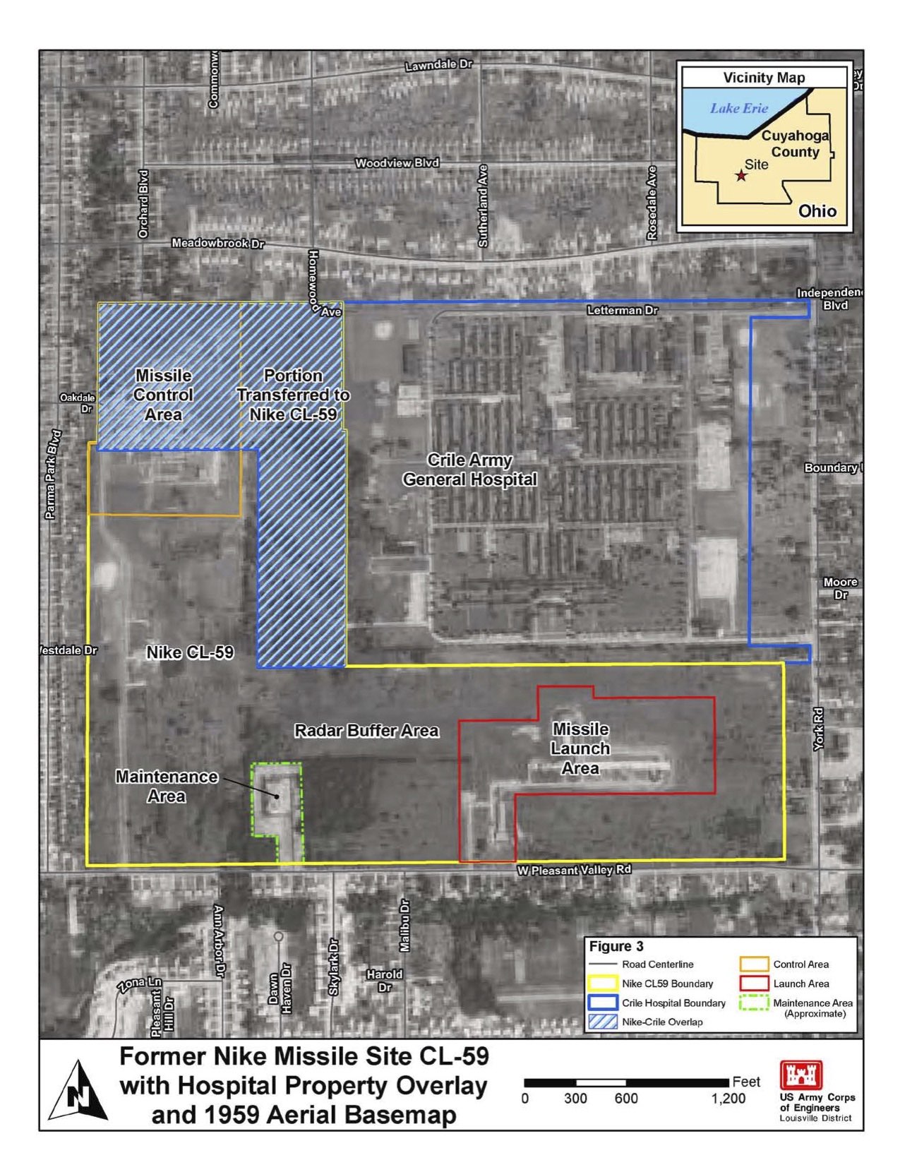
Here, the same map from the previous image is featured, however this version includes Crile Hospital's territory outlined in blue. Additionally, the area where CL-59's land intersects with the hospital's is gridded. | Creator: U.S. Army Corps of Engineers Louisville District | Date: August 4, 2010 | Source: Proposed Plan for the Former Nike Site CL-59Download Original File
Creator
U.S. Army Corps of Engineers Louisville District
Source
Proposed Plan for the Former Nike Site CL-59
Date
August 4, 2010
"Nike Site CL-59 1959 Aerial Map with Crile Hospital Overlay" appears in: Nike Site CL-59