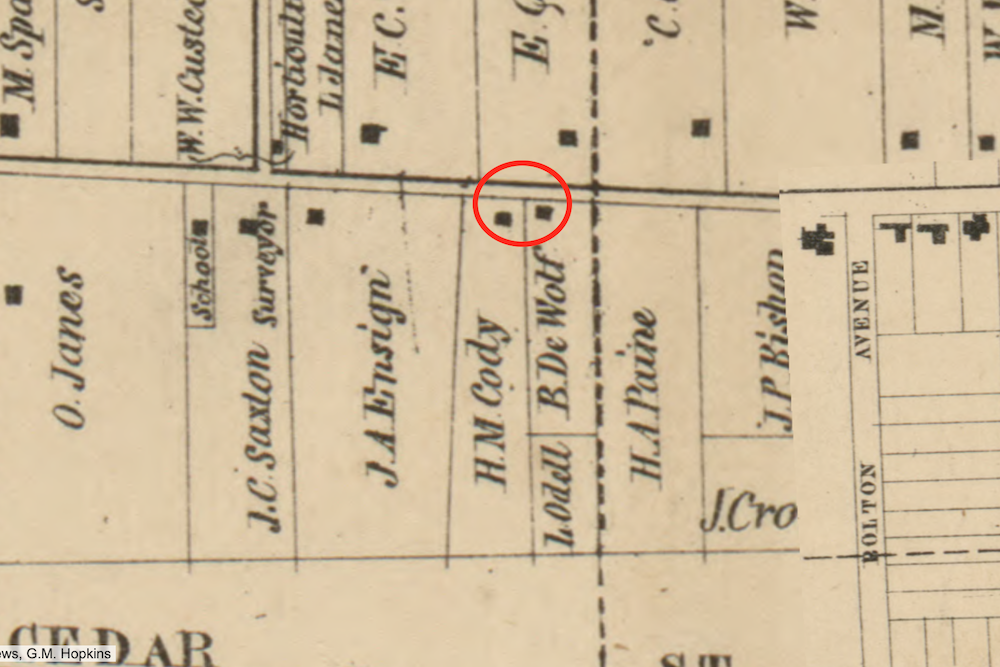
There are no known maps of the section of Euclid Avenue where Philip Cody's 55-acre farm was located that predate his death in 1850. This 1858 Cuyahoga County map shows the frontage of his farm--the two lots circled in red--as well as black squares that represent the two farm houses that stood on the land when Philip Cody was alive. The house on the DeWolf property was prior to 1850 the home of Joseph A. Cody, Philip's son. The house on the H.M. Cody property was the home of Philip Cody. In 1858, this section of the farm was part of East Cleveland Township. It was annexed to Cleveland in 1872. | Source: Cleveland Public Library, Digital Map CollectionDownload Original File