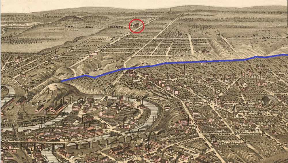
The City Hospital on Scranton Road is circled in red on this famous 1877 map of Cleveland and parts south. It provides a good visualization of not only how distantly located the hospital was from the then urbanized areas of Cleveland, but also just how rural the Cleveland area itself was beyond the Walworth Run (the blue line), located only a half mile south of Lorain Avenue.
Image courtesy of Cleveland Public Library, Digital Map CollectionDownload Original File