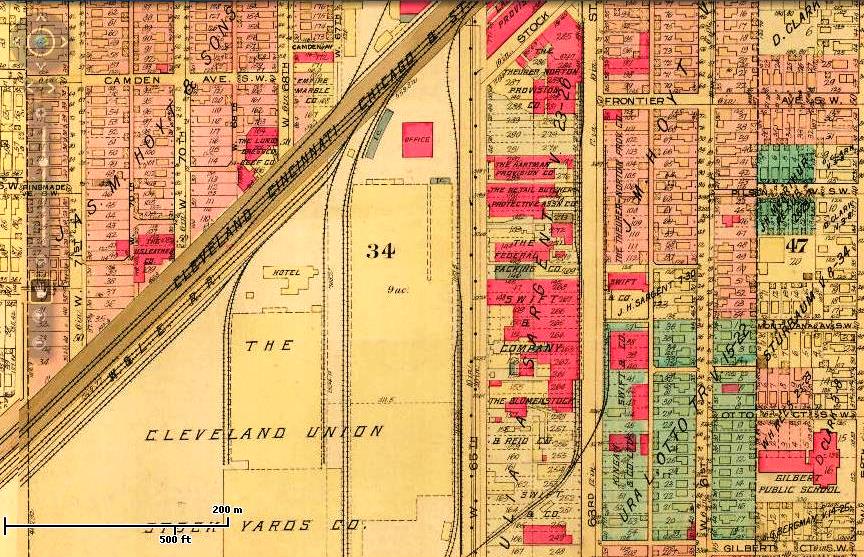
This 1922 Cleveland map graphically shows a typical geographical relationship between stockyards, railroads and meat packing houses in large American cities of the early twentieth century. The stockyards--the large yellow buildings on the left received cattle, hogs and sheep from the railroads--shown as the brown slanted line in the upper left of the map. Many of the animals in the stockyards were eventually sold to, slaughtered at, and processed in the meat packing houses--the red buildings to the right of the yellow buildings across W. 65th Street.
Image courtesy of Cleveland Public Library, Digital Map CollectionDownload Original File